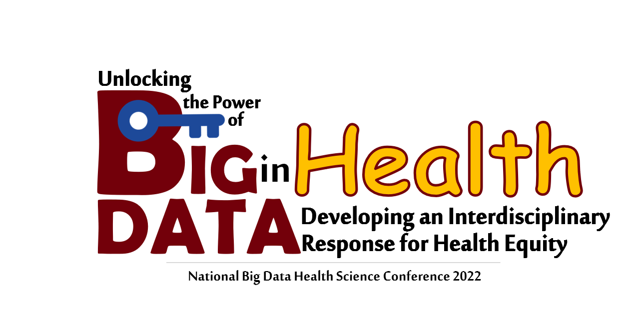
Select Page

News

.

“Spatiotemporal patterns of human mobility and its association with land use types during COVID-19 in New York City” published in IJGI

The paper titled “Spatiotemporal patterns of human mobility and its association with land use types during COVID-19 in New York City”, led by Yuqin Jiang, is published in ISPRS International Journal of Geo-Information.

Abstract: The novel coronavirus disease (COVID-19) pandemic has impacted every facet of society. One of the non-pharmacological measures to contain the COVID-19 infection is social distancing. Federal, state, and local governments have placed multiple executive orders for human mobility reduction to slow down the spread of COVID-19. This paper uses geotagged tweets data to reveal the spatiotemporal human mobility patterns during this COVID-19 pandemic in New York City. With New York City open data, human mobility pattern changes were detected by different categories of land use, including residential, parks, transportation facilities, and workplaces. This study further compares human mobility patterns by land use types based on an open social media platform (Twitter) and the human mobility patterns revealed by Google Community Mobility Report cell phone location, indicating that in some applications, open-access social media data can generate similar results to private data. The results of this study can be further used for human mobility analysis and the battle against COVID-19.

Read the full paper here.

Zhenlong Li will give a presentation on “Measuring Global Multi-Scale Place Connectivity using Geotagged Social Media Data”

Invited by SafeGraph, Zhenlong Li will be giving a presentation to the SafeGraph/Placekey Slack community — a community of over 8000 researchers and data scientists on Tuesday, June 22 at 1:00 PM – 1:45 PM EDT.

Place connectivity – shaped by human movement – is quantified by the strength of spatial interactions among locations. Using social media data, they introduce a global multi-scale place connectivity index (PCI) based on spatial interactions among places that have been geotagged in tweets. This analysis can enable modeling the spread of COVID-19 and hurricane evacuation destination choices, helping with future policy and planning procedures.

Call for papers: Special Issue “Spatial Analytics for COVID-19 Studies” by the International Journal of Environmental Research and Public Health

Dear Colleagues,

Coronavirus disease 2019 (COVID-19) is a global threat that has led to many health, economic, and social challenges. The spread of the severe acute respiratory syndrome coronavirus-2 (SARS-CoV-2) that caused the COVID-19 pandemic is inherently a spatial process. Therefore, geospatial data, algorithms, models, tools, and platforms play an irreplaceable role in providing situational awareness that benefits decision making. The notable advances in Geographical Information Sciences (GIScience) have encouraged the incorporation of spatial analytics into various epidemiological studies over the past decade.

In this Special Issue, we focus on the development and application of advanced spatial analytics towards understanding the transmission and impacts of COVID-19. We invite contributions that address this general topic from a broad spectrum of data sources (public health, economics, socio-demographics, social media, mobile phone data, transportation records, surveys, etc.) and via a variety of spatial analytics including (but not limited to) spatial statistics, agent-based simulation, digital contact tracing, case forecasting, disease transmission modeling, geo-aware analysis, spatiotemporal prediction, intelligent algorithms (i.e., machine learning and deep learning), and big data analytics. We also welcome studies that produce, design, and develop shareable COVID-19 modeling-related data, online visualization/analytical platforms, and reusable analytical tools, packages, and models.

Manuscript Submission Information

Manuscripts should be submitted online at www.mdpi.com by registering and logging in to this website. Once you are registered, click here to go to the submission form. Manuscripts can be submitted until the deadline. All papers will be peer-reviewed. Accepted papers will be published continuously in the journal (as soon as accepted) and will be listed together on the special issue website. Research articles, review articles as well as short communications are invited. For planned papers, a title and short abstract (about 100 words) can be sent to the Editorial Office for announcement on this website.

Submitted manuscripts should not have been published previously, nor be under consideration for publication elsewhere (except conference proceedings papers). All manuscripts are thoroughly refereed through a single-blind peer-review process. A guide for authors and other relevant information for submission of manuscripts is available on the Instructions for Authors page. International Journal of Environmental Research and Public Health is an international peer-reviewed open access semimonthly journal published by MDPI.

Please visit the Instructions for Authors page before submitting a manuscript. The Article Processing Charge (APC) for publication in this open access journal is 2300 CHF (Swiss Francs). Submitted papers should be well formatted and use good English. Authors may use MDPI’s English editing service prior to publication or during author revisions.


Special Issue Editors

Dr. Tao Hu E-Mail Website
Center for Geographic Analysis, Harvard University, 1737 Cambridge Street, Cambridge, MA 02138, USA
Interests: spatial modelling; geospatial big data analysis; health geography; urban crime analysis
Dr. Zhenlong Li E-Mail Website
Geoinformation and Big Data Research Laboratory (GIBD), Department of Geography, University of South Carolina, Columbia, SC 29208, USA
Interests: GIScience; spatial computing; geospatial big data; social media analytics; CyberGIS
Special Issues and Collections in MDPI journals
Dr. Xiao Huang E-Mail Website
Department of Geosciences, University of Arkansas, Fayetteville, AR 72701, USA
Interests: geospatial analysis; remote sensing; big data analytics; geovisualization; data fusion

See more information at https://www.mdpi.com/journal/ijerph/special_issues/Spatial_COVID_19

Paper “Social Distance Integrated Gravity Model for Evacuation Destination Choice” published in International Journal of Digital Earth

Paper entitled “Social Distance Integrated Gravity Model for Evacuation Destination Choice” authored by Yuqin Jiang, Zhenlong Li, and Susan L. Cutter, is published in the International Journal of Digital Earth.

Abstract: Evacuation is an effective and commonly taken strategy to minimize death and injuries from an incoming hurricane. For decades, interdisciplinary research has contributed to a better understanding of evacuation behavior. Evacuation destination choice modeling is an essential step for hurricane evacuation transportation planning. Multiple factors are identified associated with evacuation destination choices, in which long-term social factors have been found essential, yet neglected, in most studies due to difficulty in data collection. This study utilized long-term human movement records retrieved from Twitter to (1) reinforce the importance of social factors in evacuation destination choices, (2) quantify individual-level familiarity measurement and its relationship with an individual’s destination choice, (3) develop a big data approach for aggregated county-level social distance measurement, and (4) demonstrate how gravity models can be improved by including both social distance and physical distance for evacuation destination choice modeling.

Full text: https://www.tandfonline.com/doi/full/10.1080/17538947.2021.1915396 

Call for Papers: Special Issue “Big Data in Marine Science” in the Journal of Marine Science and Engineering
Dear Colleagues,


With the development of data acquisition techniques, observation sensors, and social networks, a large volume of marine-related data has been rapidly generated, which has opened a new door for studying the intricate dynamics of the huge ocean ecosystem and better understanding of how our oceans influence our planet. However, it is still challenging to uncover the hidden knowledge under these big data due to the complexity involved in the big data management technologies and analytics methodologies. This Special Issue encourages researchers to submit original papers related to innovative approaches for big marine data management, analytics, and visualization. Potential topics include (but are not limited to) the following:

  • Computing infrastructures for big marine data acquisition, query, management, and sharing.
  • Advanced data cleaning, fusion, validation, and mining approaches for big marine data from difference sources.
  • New data structures, algorithms, and frameworks for distributed processing and analytics of big marine data.
  • New methodologies and systems for big marine data visualization and mapping.
  • Applications of using big marine data to support scientific studies and decision making.
  • Other research and visions related to big marine data management and analytics.

Special Issue Editors

Dr. Fei Hu
Microsoft, Mountain View, CA, USA
Interests: geographic information science; remote sensing; big data; spatial data analytics and visualization; machine learning; artificial intelligence

Dr. Zhenlong Li

Geoinformation and Big Data Research Laboratory (GIBD), Department of Geography, University of South Carolina, Columbia, SC 29208, USA
Interests: GIScience; geospatial big data; social media analytics; high performance computing; CyberGIS; GeoAI

https://www.mdpi.com/journal/jmse/special_issues/big_data_marine_science

Paper accepted by JMIR: “Spatial-temporal relationship between population mobility and COVID-19 outbreaks in South Carolina: A time series forecasting analysis”

Our new paper entitled “Spatial-temporal relationship between population mobility and COVID-19 outbreaks in South Carolina: A time series forecasting analysis”, co-authored by Chengbo Zeng, Jiajia Zhang, Zhenlong Li, Xiaowen Sun, Bankole Olatosi, Sharon Weissman, Xiaoming Li, has been accepted for publication by JMIR .

Background Population mobility is closely associated with coronavirus 2019 (COVID-19) transmission, and it could be used as a proximal indicator to predict future outbreaks, which could inform proactive non-pharmaceutical interventions for disease control. South Carolina (SC) is one of the states which reopened early and then suffered from a sharp increase of COVID-19.

Objective To examine the spatial-temporal relationship between population mobility and COVID-19 outbreaks and use population mobility to predict daily new cases at both state- and county- levels in SC.

Methods This longitudinal study used disease surveillance data and Twitter-based population mobility data from March 6 to November 11, 2020 in SC and its top five counties with the largest number of cumulative confirmed cases. Daily new case was calculated by subtracting the cumulative confirmed cases of previous day from the total cases. Population mobility was assessed using the number of users with travel distance larger than 0.5 mile which was calculated based on their geotagged twitters. Poisson count time series model was employed to carry out the research goals.

Results Population mobility was positively associated with state-level daily COVID-19 incidence and those of the top five counties (i.e., Charleston, Greenville, Horry, Spartanburg, Richland). At the state-level, final model with time window within the last 7-day had the smallest prediction error, and the prediction accuracy was as high as 98.7%, 90.9%, and 81.6% for the next 3-, 7-, 14- days, respectively. Among Charleston, Greenville, Horry, Spartanburg, and Richland counties, the best predictive models were established based on their observations in the last 9-, 14-, 28-, 20-, and 9- days, respectively. The 14-day prediction accuracy ranged from 60.3% to 74.5%.

Conclusions Population mobility was positively associated with COVID-19 incidences at both state- and county- levels in SC. Using Twitter-based mobility data could provide acceptable prediction for COVID-19 daily new cases. Population mobility measured via social media platform could inform proactive measures and resource relocations to curb disease outbreaks and their negative influences.

Read the preprint version here: https://www.medrxiv.org/content/10.1101/2021.01.02.21249119v2.full

Call for papers: Promoting Urban Computational Paradigms with Shareable Data, Models, Tools, and Frameworks

The following special issue in Computational Urban Science is open for submissions. The submission deadline is Mar 31, 2022. Manuscript can be submitted at any time before the deadline. Once it is accepted, it will be published online immediately with open access and social media promotion.

Call for papers:

Promoting Urban Computational Paradigms with Shareable Data, Models, Tools, and Frameworks

Guest Editors:

Dr. Xiao Huang, University of Arkansas, xh010@uark.edu

Dr. Alexander Hohl, University of Utah, alexander.hohl@geog.utah.edu

Dr. Zhenlong Li, University of South Carolina, zhenlong@mailbox.sc.edu

Aims and Scope:

Although the Big Data Era provides countless opportunities with the emerging of innovative data sources, it also poses new challenges, among which reproducibility and replicability (R & R) is facing a growing awareness (Kedron et al., 2021). The extensive usage of urban monitoring big data, such as satellite imagery, location-based services, street views, to list a few, uniquely emphasizes the importance of R & R in Urban Science from the intertwining perspectives of location privacy, geospatial data quality, computing scalablility, geoinformation shareability, and conclusion generalizability. To support reproducible computational studies, Choi et al. (2021) identified three thrusts: 1) open sharing of data and models online; 2) encapsulating computational models through containers and self-documented tutorials; and 3) developing Application Programming Interfaces (APIs) for programmatic control of complex computational models. In addition, other venues exist where R & R can be promoted, such as the development of visualization frameworks, data-sharing portals, and integrated cyberinfrastructures (e.g., Li et al., 2020).

In response to the R & R challenges in Urban Science and the growing open-sourcing trend in academia, this special issue of  Computational Urban Science encourages the submission of original papers that focus on tackling urban issues and problems by designing shareable data/products, developing analytical tools, launching online data visualization portals, constructing integrated cyberinfrastructures, and so on.

Submitted manuscripts could cover but not limited to the following themes:

  • Shareable urban monitoring data and products that benefit urban science communities.
  • Online visualization, analytical, and data-sharing platforms that promote and facilitate data- and knowledge-sharing for both academia and the public.
  • Development of reusable and interoperable analytical tools, packages, models, and data-accessing portals/APIs that advance urban sciences.
  • Applied urban studies using designed data products, models, tools, and platforms.
  • Other research and visions related to reproducibility and replicability in computational urban science.

Please submit your article here:  https://www.editorialmanager.com/cusc/

Reference:

Kedron, P., Li, W., Fotheringham, S., & Goodchild, M. (2021). Reproducibility and replicability: opportunities and challenges for geospatial research. International Journal of Geographical Information Science, 35(3), 427-445.

Choi, Y. D., Goodall, J. L., Sadler, J. M., Castronova, A. M., Bennett, A., Li, Z., … & Tarboton, D. G. (2021). Toward open and reproducible environmental modeling by integrating online data repositories, computational environments, and model Application Programming Interfaces. Environmental Modelling & Software, 135, 104888.

Li, Z., Huang, Q., Jiang, Y., & Hu, F. (2020). SOVAS: a scalable online visual analytic system for big climate data analysis. International Journal of Geographical Information Science, 34(6), 1188-1209.

https://www.springer.com/journal/43762/updates/19013860

Zhenlong Li is invited to give a talk on Measuring place connectivity using big social media data in the CPGIS Educational Webinar series

Zhenlong Li was invited to give a talk this Thursday (03/25) at 9:00 – 10:00 PM (EDT) on measuring global multi-scale human mobility and place connectivity using big social media data. Dr. Tao Hu from Harvard University will demo how to use ODT Flow APIs and KNIME workflow to access and analyze the derived mobility flows.

—-Update—

The recording and power point slides are available for download at Harvard Dataverse (see links below).

CPGIS Educational Webinars on Spatiotemporal Study of Urban Dynamics (3)

9:00 PM-10:00 PM, Thursday, Mar 25, 2021 (US EDT)

Measuring place connectivity using big social media data”, Dr. Zhenlong Li, University of South Carolina

Chair:   Song Gao, University of Wisconsin-Madison

Recording: https://doi.org/10.7910/DVN/XJIZJG

PPT: https://doi.org/10.7910/DVN/XJIZJG

For future events of this series, check here:

https://www.eventbrite.com/e/cpgis-educational-webinars-on-spatiotemporal-study-of-urban-dynamics-tickets-141192579807

Check out our updated ODT (Origin-Destination-Time) Flow Explorer to explore worldwide human mobility.

Welcome to check out our updated ODT (Origin-Destination-Time) Flow Explorer to explore worldwide human mobility at various geographic scales. Twitter-derived flows are updated to 12/31/2020, and SafeGraph-derived flows are updated to 02/24/2021. Two new geographic levels including the world first-level subdivision and US census tract (for South Carolina and Texas) are added.

Use this link for the Explorer: https://lnkd.in/gebgvDa
And this link for the new Video Tutorial: https://lnkd.in/eVvt9Dn
Preprint article: https://lnkd.in/eb3PM5J

Welcome to join the CPGIS Webinar Series CPGIS Educational Webinar Series on “Spatiotemporal Study of Urban Dynamics”

CPGIS Educational Webinar Series on “Spatiotemporal Study of Urban Dynamics”

With the increased population, continuously propelling of urbanization and climate change, cities are facing unprecedented challenges regarding various safety, security, and health issues. Meanwhile, the increasing penetration of digital technologies is changing the way we perceive cities. This bi-weekly webinar series will focus on the spatiotemporal study of urban dynamics with invited talks on theories, data, methods, tools, and empirical studies of urban growth and safety in environment, public health, disaster, public security, crime, etc. The webinars are open to the public.

Register Now

https://www.eventbrite.com/e/141192579807


Presentations:

9:00PM-10:00 PM, Thursday, Feb 25, 2021 (US EDT)

“Tracking and modeling diseases in urban spaces”, Dr. Xun Shi, Dartmouth College

Chair: Hui Lin, Jiangxi Normal University


9:00PM-10:00 PM, Thursday, Mar 11, 2021 (US EDT)

“Computational Urban Science”, Dr. Xinyue Ye, Texas A&M University

Chair: Qiusheng Wu, University of Tennessee


9:00PM-10:00 PM, Thursday, Mar 25, 2021 (US EDT)

“Measuring place connectivity using big social media data“, Dr. Zhenlong Li, University of South Carolina

Chair: Song Gao, University of Wisconsin-Madison


9:00PM-10:00 PM, Thursday, April 8, 2021 (US EDT)

“Global urban land dynamics monitoring”, Dr. Peng Gong, University of Hong Kong

Chair: CuiZhen Wang, University of South Carolina


9:00PM-10:00 PM, Thursday, April 22, 2021 (US EDT)

“Deep learning and process understanding for data-driven urban prediction”, Dr. Feng Zhang, Zhejiang University

Chair: Min Chen, Nanjing Normal University


9:00PM-10:00 PM, Thursday, May 6, 2021 (US EDT)

“Impacts of Ride-hailing on Urban Mobility”。Dr. Hui Kong, University of Minnesota

Chair: Fan Zhang, MIT


9:00PM-10:00 PM, Thursday, May 20, 2021 (US EDT)

“Utilizing spatiotemporal computing to address air quality and urban heat problems”, Dr. Chaowei Yang, Georgia Mason University

Chair: Wendy Guan, Harvard University

Measure Place Connectivity Using Big Social Media Data: introducing a Twitter-based worldwide place connectivity dataset

Shaped by human movement, place connectivity is quantified by the strength of spatial interactions among locations. For decades, spatial scientists have researched place connectivity, applications, and metrics. The growing popularity of social media provides a new data stream where spatial social interaction measures are largely devoid of privacy issues, easily assessable, and harmonized. In this study, we introduced a place connectivity index (PCI) based on spatial interactions among places revealed by geotagged tweets as a multiscale, spatiotemporal-continuous, and easy-to-implement measurement. The proposed PCI, established and demonstrated at the US county level, exhibits a strong positive association with SafeGraph population movement records (10% penetration in the US population) and Facebook’s social connectedness index (SCI), a popular connectivity index based on social networks. We found that PCI has a strong state boundary effect and that it generally follows the distance decay effect, although this force is weaker in more urbanized counties with a denser population. Our investigation further suggests that PCI has great potential in addressing real-world problems that require place connectivity knowledge, exemplified with two applications: 1) modeling the spatial spread of a contagious disease (e.g., COVID-19), and 2) modeling hurricane evacuation destination choices. The methodological and contextual knowledge of PCI, together with the launched visualization platform and data sharing capability, is expected to support research fields requiring knowledge in human spatial interactions.

The interactive web portal for visualizing the PCI and relevant datasets can be accessed at http://gis.cas.sc.edu/GeoAnalytics/pci.html.

Download PCI and relevant datasets at https://github.com/GIBDUSC/Place-Connectivity-Index

Read the preprint article…


Figure below shows the interactive web portal for PCI visualization. The map shows the PCI for Cook County (Chicago), Illinois, to all other counties.

PCI from England, UK to other world first-level subdivisions.

Our population mobility data are used by WorldPop to analyze the spread of new COVID-19 variants from the UK, South Africa and Brazil

Our population mobility data has been used by Worldpop (https://www.worldpop.org) to analyze the spread of new COVID-19 variants from the UK, South Africa and Brazil. Check out the article here: https://www.worldpop.org/events/covid_variants


Paper accepted for publication by the International Journal of Digital Earth

Our article titled “The characteristics of multi-source mobility datasets and how they reveal the luxury nature of social distancing in the U.S. during the COVID-19 pandemic”, authored by Xiao Huang, Zhenlong Li, Yuqin Jiang, Xinyue Ye, Chengbin Deng, Jiajia Zhang, and Xiaoming Li, is accepted for publication in the International Journal of Digital Earth.

Abstract:  This study reveals the human mobility from various sources and the luxury nature of social distancing in the U.S during the COVID-19 pandemic by highlighting the disparities in mobility dynamics from lower-income and upper-income counties. We collect, process, and compute mobility data from four sources: 1) Apple mobility trend reports, 2) Google community mobility reports, 3) mobility data from Descartes Labs, and 4) Twitter mobility calculated via weighted distance. We further design a Responsive Index (RI) based on the time series of mobility change percentages to quantify the general degree of mobility-based responsiveness to COVID-19 at the U.S. county level. We find statistically significant positive correlations in the RI between either two data sources, revealing their general similarity, albeit with varying Pearson’s r coefficients. Despite the similarity, however, mobility from each source presents unique and even contrasting characteristics, in part demonstrating the multifaceted nature of human mobility. The positive correlation between RI and income at the county level is significant in all mobility datasets, suggesting that counties with higher income tend to react more aggressively in terms of reducing more mobility in response to the COVID-19 pandemic. Most states present a positive difference in RI between their upper-income and lower-income counties, where diverging patterns in time series of mobility changes percentages can be found. To our best knowledge, this is the first study that cross-compares multi-source mobility datasets. The findings shed light on not only the characteristics of multi-source mobility data but also the mobility patterns in tandem with the economic disparity.

Read a preprint version of the article here.


New article “Simulating multi-exit evacuation using deep reinforcement learning” accepted by Transactions in GIS

New article “Simulating multi-exit evacuation using deep reinforcement learning”, authored by Dong Xu, Xiao Huang, Joseph Mango, Xiang Li, and Zhenlong Li, is accepted for publication by Transactions in GIS

Abstract: Conventional simulations on multi-exit indoor evacuation focus primarily on how to determine a reasonable exit based on numerous factors in a changing environment. Results commonly include some congested and other under-utilized exits, especially with massive pedestrians. We propose a multi-exit evacuation simulation based on Deep Reinforcement Learning (DRL), referred to as the MultiExit-DRL, which involves a Deep Neural Network (DNN) framework to facilitate state-to-action mapping. The DNN framework applies Rainbow Deep Q-Network (DQN), a DRL algorithm that integrates several advanced DQN methods, to improve data utilization and algorithm stability and further divides the action space into eight isometric directions for possible pedestrian choices. We compare MultiExit-DRL with two conventional multi-exit evacuation simulation models in three separate scenarios: 1) varying pedestrian distribution ratios, 2) varying exit width ratios, and 3) varying open schedules for an exit. The results show that MultiExit-DRL presents great learning efficiency while reducing the total number of evacuation frames in all designed experiments. In addition, the integration of DRL allows pedestrians to explore other potential exits and helps determine optimal directions, leading to the high efficiency of exit utilization.

Read full article here. 

New article proposing for a predictive model for COVID-19 using big data analytics is published in JMIR Research Protocols

Our new paper authored by Zhenlong Li, Xiaoming Li, Dwayne Porter, Jiajia Zhang, Yuqin Jiang, Bankole Olatosi, and Sharon Weissman titled “Monitoring the Spatial Spread of COVID-19 and Effectiveness of Control Measures Through Human Movement Data: Proposal for a Predictive Model Using Big Data Analytics” is published in JMIR Research Protocols . 

Full paper can be accessed here: http://dx.doi.org/10.2196/24432

Background and objective: Human movement is one of the forces that drive the spatial spread of infectious diseases. To date, reducing and tracking human movement during the COVID-19 pandemic has proven effective in limiting the spread of the virus. Existing methods for monitoring and modeling the spatial spread of infectious diseases rely on various data sources as proxies of human movement, such as airline travel data, mobile phone data, and banknote tracking. However, intrinsic limitations of these data sources prevent us from systematic monitoring and analyses of human movement on different spatial scales (from local to global).  Big data from social media such as geotagged tweets have been widely used in human mobility studies, yet more research is needed to validate the capabilities and limitations of using such data for studying human movement at different geographic scales (eg, from local to global) in the context of global infectious disease transmission. This study aims to develop a novel data-driven public health approach using big data from Twitter coupled with other human mobility data sources and artificial intelligence to monitor and analyze human movement at different spatial scales (from global to regional to local).

New book published by Routledge “Social Sensing and Big Data Computing for Disaster Management”

Our new book, edited by Zhenlong Li, Qunying Huang, and Chris Emrich is published by Routledge. The book is published from a very successful special issue in the International Journal of Digital Earth.

https://www.routledge.com/Social-Sensing-and-Big-Data-Computing-for-Disaster-Management/Li-Huang-T-Emrich/p/book/9780367617653

Paper accepted by ADIS journal: “Building a Social media-based HIV Risk Behavior Index to Inform the Prediction of HIV New Diagnosis”

Our paper “Building a Social media-based HIV Risk Behavior Index to Inform the Prediction of HIV New Diagnosis: A Feasibility Study”, authored by Zhenlong Li, Shan Qiao, Yuqin Jiang, and Xiaoming Li, is accepted for publication by AIDS journal.

Objective: Analysis of geolocation-based social media Big Data provides unprecedented opportunities for a broad range of domains including health, as health is intrinsically linked to the geographic characteristics of places. HIV infection is largely driven by HIV risk behaviors such as unsafe sexual behavior and drug abuse/addiction. This study explores the feasibility of building a Social media-based HIV Risk Behavior index (SRB) at the county level for informing HIV surveillance and prevention, considering social determinants of health and geographic locations.

Welcome to register for our 2021 Big Data Health Science Conference, February 5-6, 2021

The University of South Carolina Big Data Health Science Center (BDHSC) is pleased to announce its 2021 Big Data Health Science Conference. Highlights of the virtual conference include keynote and panel speakers from diverse areas of the health sciences, government, and academia. Our decision to move the conference to a virtual format means attendees will have the ability to attend poster sessions, networking events, and breakout sessions in areas of electronic health records, geospatial, social media, genomics, and bionanomaterial research from the safety and comfort of their homes.

Register the conference at https://www.sc-bdhs-conference.org/


Welcome to check out our new tool: ODT Flow Explorer
Welcome to check out our new APP, called ODT Flow Explorer (http://gis.cas.sc.edu/GeoAnalytics/od.html), where you can query, visualize, and download human mobility data derived from billions of geotagged tweets and SafeGraph Social Distancing Metrics. 
Call for papers – AAG 2021: Social Media and Big Data for Disasters

We invite you to submit your abstract to our session, Social Media and Big Data for Disasters, at the upcoming virtual American Association of Geographers Annual Meeting, April 7-11, 2021. The session will bring together basic and empirical research that advances existing understanding and techniques to address the issue of big data quality and its impact on applications pertaining to human dynamics, built environments and hazards. Potential research topics include, but are not limited to:

  • Quality issues in big data
  • Calibration and validation techniques/approaches in big data
  • Data integration of multi-source and/or heterogenous datasets
  • Big data analytics in hazards and built environment
  • Big data analytics in human movements and behaviors
  • Big data quality and its impact in decision making
  • Challenges in collecting, processing and analyzing big data for real-time applications
  • Geo-visualization techniques to analyze and visualize social media data
  • Privacy and big data management

If you would like to be included in the session, please submit your abstract here by Thursday, November 19th and send a copy of your abstract and PIN to Dr. Bandana Kar (karb@ornl.gov). Let us know if you have any questions – we look forward to receiving your submissions!

Sincerely,

Bandana Kar
Research Scientist, Oak Ridge National Laboratory

Edwin T. Chow
Associate Professor, Texas State University

Zhenlong Li
Associate Professor, University of South Carolina

Qunying Huang
Associate Professor, University of Wisconsin

Our paper “Twitter reveals human mobility dynamics during the COVID-19 pandemic” is published in PloS One !

Abstract: The current COVID-19 pandemic raises concerns worldwide, leading to serious health, economic, and social challenges. The rapid spread of the virus at a global scale highlights the need for a more harmonized, less privacy-concerning, easily accessible approach to monitoring the human mobility that has proven to be associated with viral transmission. In this study, we analyzed over 580 million tweets worldwide to see how global collaborative efforts in reducing human mobility are reflected from the user-generated information at the global, country, and U.S. state scale. Considering the multifaceted nature of mobility, we propose two types of distance: the single-day distance and the cross-day distance. To quantify the responsiveness in certain geographic regions, we further propose a mobility-based responsive index (MRI) that captures the overall degree of mobility changes within a time window. The results suggest that mobility patterns obtained from Twitter data are amenable to quantitatively reflect the mobility dynamics. Globally, the proposed two distances had greatly deviated from their baselines after March 11, 2020, when WHO declared COVID-19 as a pandemic. The considerably less periodicity after the declaration suggests that the protection measures have obviously affected people’s travel routines. The country scale comparisons reveal the discrepancies in responsiveness, evidenced by the contrasting mobility patterns in different epidemic phases. We find that the triggers of mobility changes correspond well with the national announcements of mitigation measures, proving that Twitter-based mobility implies the effectiveness of those measures. In the U.S., the influence of the COVID-19 pandemic on mobility is distinct. However, the impacts vary substantially among states.

Read full paper here: https://doi.org/10.1371/journal.pone.0241957

Post-doctoral Fellow Positions at UofSC Big Data Health Science Center

The Big Data Health Science Center (BDHSC) at University of South Carolina (UofSC) Arnold School of Public Health invites applications for two post-doctoral research fellow positions. The qualified candidates will be expected to participate in funded Big Data projects in HIV and COVID-19 research. The primary responsibilities of the post-doctoral fellows may include, but are not limited to, literature review, data management and analysis, preparation of manuscripts, grant writing, and other related tasks. We are seeking highly motivated candidates with long-term interest in a research career in an academic setting. The applicants must have a doctoral degree in a health data-related field (e.g., public health, statistics, biostatistics, or quantitative psychology), by the time of appointment. Other qualifications include expertise in quantitative methodology and statistics, strong analytic skills, ability to take initiative and work independently, high standard of work ethic, effective oral and written communication skills, and proficiency in SPSS, SAS, STATA, R, or other statistical programming. Previous research experiences in HIV, COVID-19, or data analytics are preferred. The initial appointment for the positions will be one year but renewable contingent upon job performance and the availability of funding. For prompt consideration, please submit your application at the UofSC Human Resources web site uscjobs.sc.edu/postings/89660 (Posting # STA00678PO20). For inquires please contact Dr. Xiaoming Li at XIAOMING@mailbox.sc.edu. Review of applications will begin immediately but the positions will remain open until filled.

New book published by MPDI “Big Data Computing for Geospatial Applications”

This book is published from the successful special issue “Big Data Computing for Geospatial Applications” in ISPRS International Journal of Geo-Information.

Download the full book here: https://www.mdpi.com/books/pdfview/book/3121

New preprint on time-series clustering for home dwell time during COVID-19: what can we learn from it?

In this study, we investigate the potential driving factors that lead to the disparity in the time-series of home dwell time, aiming to provide fundamental knowledge that benefits policy-making for better mitigation strategies of future pandemics. Taking Metro Atlanta as a study case, we perform a trend-driven analysis by conducting Kmeans time-series clustering using fine-grained home dwell time records from SafeGraph, and further assess the statistical significance of sixteen demographic/socioeconomic variables from five major categories. We find that demographic/socioeconomic variables can explain the disparity in home dwell time in response to the stay-at-home order, which potentially leads to disparate exposures to the risk from the COVID-19. The results further suggest that socially disadvantaged groups are less likely to follow the order to stay at home, pointing out the extensive gaps in the effectiveness of social distancing measures exist between socially disadvantaged groups and others. Our study reveals that the long-standing inequity issue in the U.S. stands in the way of the effective implementation of social distancing measures. Policymakers need to carefully evaluate the inevitable trade-off among different groups, making sure the outcomes of their policies reflect interests of the socially disadvantaged groups.

Read full article…

Call for papers: Special Issue “GIScience for Risk Management in Big Data Era” in ISPRS International Journal of Geo-Information

https://www.mdpi.com/si/61242 

GIScience for Risk Management in Big Data Era

Deadline for manuscript submissions: 31 July 2021.

Dear Colleagues,
According to the updated “2009 UNISDR Terminology”(Terminology of UNISDR, 2016) and modified Terminology of UN DRR (2019), disaster risk management (DRM) is the application of disaster risk reduction policies and strategies to prevent new disaster risk, reduce existing disaster risk, and manage residual risk, contributing to the strengthening of resilience and reduction of disaster losses. Disaster risk reduction (DRR) is aimed at preventing new while reducing existing disaster risk and managing residual risk, all of which contribute to strengthening resilience and, therefore, to the achievement of sustainable development. In other words, DRR is the policy objective of disaster risk management, and its goals and objectives are defined in disaster risk reduction strategies and plans.
New concepts and strategies are being developed and also improved by changing the scientific and data frameworks in which new approaches are applied. We are now living in the big data era, with efforts toward creating smart solutions and developing data-driven geography and new approaches in various disciplines, like cyberspace questions. Taken together, these have led to the creation of new knowledge and a technological situation with new[…]  Read more…

Special Issue Editors

Prof. Dr. Milan Konecny Website
Guest Editor
Laboratory on Geoinformatics and Cartography, Department of Geography, Faculty of Science, Masaryk University, Kotlarska 2, 61137 BRNO, Czech Republic
Interests: disaster risk reduction; disaster mapping; context and adaptive cartography; health cartography; big spatial data

Prof. Dr. Jie Shen Website
Guest Editor
School of Geography, Nanjing Normal University, Wenyuna Road 1, 210023, Nanjing, China
Interests: disaster mapping; context and adaptive cartography; indoor navigation; map genreralization

Prof. Dr. Zhenlong Li Website
Guest Editor
Geoinformation and Big Data Research Laboratory (GIBD), Department of Geography, University of South Carolina, Columbia, SC 29208, USA
Interests: GIScience; geospatial big data; social media analytics; high performance computing; CyberGIS; GeoAI
Check out our new article published in IJDE: Taking the pulse of COVID-19: a spatiotemporal perspective

Check out our new article published in International Journal of Digital Earth (IJDE) “Taking the pulse of COVID-19: a spatiotemporal perspective

The sudden outbreak of the Coronavirus disease (COVID-19) swept across the world in early 2020, triggering the lockdowns of several billion people across many countries, including China, Spain, India, the U.K., Italy, France, Germany, Brazil, Russia, and the U.S. The transmission of the virus accelerated rapidly with the most confirmed cases in the U.S., India, Russia, and Brazil. In response to this national and global emergency, the NSF Spatiotemporal Innovation Center brought together a taskforce of international researchers and assembled implementation strategies to rapidly respond to this crisis, for supporting research, saving lives, and protecting the health of global citizens. This perspective paper presents our collective view on the global health emergency and our effort in collecting, analyzing, and sharing relevant data on global policy and government responses, human mobility, environmental impact, socioeconomical impact; in developing research capabilities and mitigation measures with global scientists, promoting collaborative research on outbreak dynamics, and reflecting on the dynamic responses from human societies.

Full paper

Our new article on using deep learning for land cover segmentation is published in Annals of GIS.

Check out our new article “Choosing an appropriate training set size when using existing data to train neural networks for land cover segmentation“.

Land cover data is an inventory of objects on the Earth’s surface, which is often derived from remotely sensed imagery. Deep Convolutional Neural Network (DCNN) is a competitive method in image semantic segmentation. Some scholars argue that the inadequacy of training set is an obstacle when applying DCNNs in remote sensing image segmentation. While existing land cover data can be converted to large training sets, the size of training data set needs to be carefully considered. In this paper, we used different portions of a high-resolution land cover map to produce different sizes of training sets to train DCNNs (SegNet and U-Net) and then quantitatively evaluated the impact of training set size on the performance of the trained DCNN. We also introduced a new metric, Edge-ratio, to assess the performance of DCNN in maintaining the boundary of land cover objects. Based on the experiments, we document the relationship between the segmentation accuracy and the size of the training set, as well as the nonstationary accuracies among different land cover types. The findings of this paper can be used to effectively tailor the existing land cover data to training sets, and thus accelerate the assessment and employment of deep learning techniques for high-resolution land cover map extraction.

Full text here

New preprint paper: The characteristics of multi-source mobility datasets and how they reveal the luxury nature of social distancing in the U.S. during the COVID-19 pandemic

Check out our new preprint paper (link to full text) for the analysis of characteristics of multi-source mobility datasets and how they reveal the luxury nature of social distancing in the U.S. during the COVID-19 pandemic.

Abstract: This study reveals the human mobility from various sources and the luxury nature of social distancing in the U.S during the COVID-19 pandemic by highlighting the disparities in mobility dynamics from lower-income and upper-income counties. We collect, process, and compute mobility data from four sources: 1) Apple mobility trend reports, 2) Google community mobility reports, 3) mobility data from Descartes Labs, and 4) Twitter mobility calculated via weighted distance. We further design a Responsive Index ( ) based on the time series of mobility change percentages to quantify the general degree of mobility-based responsiveness to COVID-19 at the U.S. county level. We find statistically significant positive correlations in the  between either two data sources, revealing their general similarity, albeit with varying Pearson’s  coefficients. Despite the similarity, however, mobility from each source presents unique and even contrasting characteristics, in part demonstrating the multifaceted nature of human mobility. The positive correlation between RI and income at the county level is significant in all mobility datasets, suggesting that counties with higher income tend to react more aggressively in terms of reducing more mobility in response to the COVID-19 pandemic. Most states present a positive difference in between their upper-income and lower-income counties, where diverging patterns in time series of mobility changes percentages can be found. To our best knowledge, this is the first study that cross-compares multi-source mobility datasets. The findings shed light on not only the characteristics of multi-source mobility data but also the mobility patterns in tandem with the economic disparity.

Book chapter “Geospatial Big Data Handling with High Performance Computing: Current Approaches and Future Directions” is published.
Book chapter “Geospatial Big Data Handling with High Performance Computing: Current Approaches and Future Directions“, authored by Zhenlong Li, is published in book High Performance Computing for Geospatial Applications

Abstract: Geospatial big data plays a major role in the era of big data, as most data today are inherently spatial, collected with ubiquitous location-aware sensors such as mobile apps, the global positioning system (GPS), satellites, environmental observations, and social media. Efficiently collecting, managing, storing, and analyzing geospatial data streams provide unprecedented opportunities for business, science, and engineering. However, handling the “Vs” (volume, variety, velocity, veracity, and value) of big data is a challenging task. This is especially true for geospatial big data since the massive datasets must be analyzed in the context of space and time. High performance computing (HPC) provides an essential solution to geospatial big data challenges. This chapter first summarizes four critical aspects for handling geospatial big data with HPC and then briefly reviews existing HPC-related platforms and tools for geospatial big data processing. Lastly, future research directions in using HPC for geospatial big data handling are discussed.

https://link.springer.com/chapter/10.1007%2F978-3-030-47998-5_4


Check out our new blog post “Human Mobility, Policy, and COVID-19: A Preliminary Analysis of South Carolina”

Using geotagged Twitter data as the mobility data source and South Carolina as the case study, we present some preliminary findings and visualizations on population flows and human mobility changes during the pandemic at state level and county level. The potential associations between human mobility, state policies, and COVID-19 cases are also examined.

Read more…

In the News from The New York Times: The Young Cut Loose in Myrtle Beach. The Virus Followed Them Home.

https://www.nytimes.com/2020/07/01/us/coronavirus-myrtle-beach.html

Check out our new paper “Twitter, human mobility, and COVID-19”
Full paper (preprint) can be accessed HERE.

Abstract: The outbreak of COVID-19 is a public health pandemic that raises wide concerns worldwide, leading to serious health, economic, and social challenges. The rapid spread of the virus at a global scale highlights the need for a more harmonized, less privacy-concerning, easily accessible approach to monitoring the human mobility that has been proved to be associated with the viral transmission. In this study, we analyzed 587 million tweets worldwide to see how global collaborative efforts in reducing human mobility are reflected from the user-generated information at the global, country, and the U.S. state scale. Considering the multifaceted nature of mobility, we propose two types of distance: the single-day distance and the cross-day distance. To quantify the responsiveness in certain geographic regions, we further propose a mobility-based responsive index (MRI) that captures the overall degree of mobility changes within a time window. The results suggest that mobility patterns obtained from Twitter data are amendable to quantitatively reflect the mobility dynamics. Globally, the proposed two distances had greatly deviated from their baselines after March 11, 2020 when WHO declared COVID-19 as a pandemic. The considerably less periodicity after the declaration suggests that the protection measures have obviously affected people’s travel routines. The country scale comparisons reveal the discrepancies in responsiveness, evidenced by the contrasting mobility patterns in different epidemic phases. We find that the triggers of mobility changes correspond well with the national announcements of mitigation measures, proving that Twitter-based mobility implies the effectiveness of those measures. In the U.S., the influence of the COVID-19 pandemic on mobility is distinct. However, the impacts varied substantially among states. The strong mobility recovering momentum is further fueled by the Black Lives Matter protests, potentially fostering the second wave of infections in the U.S.
UofSC Big Data Health Science Center investigators receive $1.25 million NIH grant to develop data-driven strategies in fighting COVID-19

Xiaoming Li (Department of Health Promotion, Education, and Behavior, Arnold School of Public Health) and Bankole Olatosi (Department of Health Services Policy and Management, Arnold School of Public Health), in collaboration with BDHSC faculty members from the Arnold School of Public Health (Jiajia Zhang), College of Arts and Sciences (Zhenlong Li), College of Engineering and Computing (Neset Hikmet and Jianjun Hu), and School of Medicine-Columbia (Sharon Weissman), have been awarded a $1,252,550 grant from the National Institute of Allergy and Infectious Diseases to develop a state-wide data-driven system to fight COVID-19 in South Carolina.

Read the story…

In the News from WLTX: UofSC researchers using Twitter to track COVID19
Through data from the popular social media app, researchers are able to answer critical questions about virus spread.
NSF Award “Monitoring the Spatial Spread of COVID-19 through the Lens of Human Movement using Big Social Media Data”

Zhenlong Li, in collaboration with Dwayne Porter and Xiaoming Li, received an NSF award “Monitoring the Spatial Spread of COVID-19 through the Lens of Human Movement using Big Social Media Data”. This project aims to provide enhanced situation awareness and offer valuable contributions to building collective public awareness of the role people play in the evolution of the COVID-19 pandemic.

Some preliminary findings: https://lnkd.in/ebr-rab

Inviting submissions to a new special issue “Scaling, Spatio-Temporal Modeling, and Crisis Informatics” by IJGI

A special issue of ISPRS International Journal of Geo-Information (ISSN 2220-9964).

Deadline for manuscript submissions: 30 April 2021.

Image preview


Dear Colleagues,

There has been a significant increase in the severity and frequency of crises and hazards worldwide, which are defined as “an interruption in the reproduction of economic, cultural, social and/or political life (Johnston, R.J. (2002). Dictionary of human geography. (4th ed.). Oxford, UK: Blackwell.)”. While extreme weather events are usually the causes of crisis, 2020 has become an expensive and deadly year due to another type of crisis, i.e., the COVID-19 pandemic. Whatever the cause of a crisis, though, technologies like cloud computing, location-based services, network science, web applications, and artificial intelligence (AI) are being used for crisis informatics to aid with crisis management and resilience efforts.

Similarly, data obtained from both static and dynamic sources, such as remote sensing, unmanned aerial systems, and social media, enable the development of new approaches to charaterize and predict disaster situations at different locations and scales. Human dynamics data in both physical and virtual spaces are big, spatial, temporal, dynamic, and unstructured. The proliferation of data and interactive mapping technologies has also significantly enhanced access to and utility of spatial decision support systems, helping communities to better prepare for, respond to, and recover from crises and hazards. Understanding human dynamics can help to more efficiently deal with natural or man-made disasters. Significant advancements have also been made in developing statistical as well as data-driven models to integrate these heterogeneous data for real-time and off-time informatics. Because of the heterogeneous nature of these data in terms of data structure, content, data sources, and the spatial and temporal resolutions at which they are being obtained, these data suffer from uncertainties associated with positional accuracy, reliability, and completeness, thereby impacting the quality of the models being generated and their reproducibility.

Due to the spatiotemporal nature of a crisis, geospatial data sets and spatiotemporal models integrating various data sources are being developed. In addition to the uncertainties associated with the data, the developed models rarely account for scale, which influences not only the mechanisms used to aggregate and integrate data sets, but also the final outputs of the model. The end result is the development of models for crisis informatics that produce varying results and hence may not be useful in real-time decision making.

In this Special Issue in ISPRS International Journal of Geo-Information, we solicit articles that advance theories and methods and/or applications integrating spatial and temporal datasets at varying scales for crisis informatics. The articles should leverage existing theories and/or develop new theories of scaling and spatiotemporal modeling while taking advantage of big data theories and technologies to aid with crisis/disaster preparedness, mitigation, recovery, and resilience.

Potential topics include (but are not limited to) the following:

  1. Uncertainty in data and spatiotemporal models;
  2. Data fusion methods and accuracies;
  3. Data quality and impact on decision making;
  4. Role of scale and reproducibility of models;
  5. Human dynamics in crises and hazards;
  6. Open knowledge network and convergence research;
  7. Spatial decision support systsem for crisis management;
  8. Geo-visualization and geo-computation techniques for real-time applications;
  9. Models and analytics for crisis, human movement and behaviors, interaction of natural and built environments.

This Special Issue is scheduled to be published by 30 April 2021. Accepted papers will be published continuously in the journal (as soon as accepted) and will be listed together on the Special Issue website.

Special Issue Editors

Dr. Bandana Kar Website
Guest Editor
Remote Sensing Group, Oak Ridge National Laboratory, P.O. Box 2008, 1 Bethel Valley, Road Oak Ridge, TN 37831-6134, USA
Interests: scaling and reproducibility; spatiotemporal modeling; geoifnormatics; risk assessment; infrastructure and community resilience; risk communication; spatial decision support system; remote sensing applications; data mining; machine learning
Special Issues and Collections in MDPI journals
Dr. Xinyue Ye Website
Guest Editor
Department of Informatics, Urban Informatics & Spatial Computation Lab, New Jersey Institute of Technology, Newark, NJ 07102, USA
Interests: network science; natural language processing; open source geocomputation; spatio-temporal analysis; spatial econometrics; urban informatics; visual analytics
Special Issues and Collections in MDPI journals
Dr. Zhenlong Li Website
Guest Editor
Geoinformation and Big Data Research Laboratory (GIBD), Department of Geography, University of South Carolina, Columbia, SC, 29208, USA
Interests: GIScience; geospatial big data analytics; high-performance computing; cybergis; social media analytics
Special Issues and Collections in MDPI journals
Dr. Qunying Huang Website
Guest Editor
Department of Geography, University of Wisconsin-Madison, Madison, WI 53706-1491, USA
Interests: spatial data mining; machine learning; social media analytics; natural hazards; human mobility
Special Issues and Collections in MDPI journals

Manuscript Submission Information

Manuscripts should be submitted online at www.mdpi.com by registering and logging in to this website. Once you are registered, click here to go to the submission form. Manuscripts can be submitted until the deadline. All papers will be peer-reviewed. Accepted papers will be published continuously in the journal (as soon as accepted) and will be listed together on the special issue website. Research articles, review articles as well as short communications are invited. For planned papers, a title and short abstract (about 100 words) can be sent to the Editorial Office for announcement on this website.

Submitted manuscripts should not have been published previously, nor be under consideration for publication elsewhere (except conference proceedings papers). All manuscripts are thoroughly refereed through a single-blind peer-review process. A guide for authors and other relevant information for submission of manuscripts is available on the Instructions for Authors page. ISPRS International Journal of Geo-Information is an international peer-reviewed open access monthly journal published by MDPI.

Please visit the Instructions for Authors page before submitting a manuscript. The Article Processing Charge (APC) for publication in this open access journal is 1000 CHF (Swiss Francs). Submitted papers should be well formatted and use good English. Authors may use MDPI’s English editing service prior to publication or during author revisions.

https://www.mdpi.com/journal/ijgi/special_issues/crisis

Dr. Zhenlong Li, collaborated with public health colleagues, receive funds from the USC COVID-19 Internal Funding Initiative

Dr. Zhenlong Li, teamed with public health colleagues Drs. Xiaoming Li and Bankole Olatosi, receives funds from the USC Office of the Vice President for Research COVID-19 Internal Funding Initiative to conduct preliminary study of a big data approach for better understanding the spatial propagation of the novel coronavirus.

https://www.sc.edu/about/offices_and_divisions/research/news_and_pubs/news/2020/20200427_covid-19_initiative_recipients.php 

Big Earth Data Analytics Special Issue Call for Papers, Deadline: 1 September 2020

Massive volumes of Earth data are being produced at an increasingly faster velocity from a variety of location-aware sensors and model simulations with increasing spatial, temporal, and spectral resolutions. Big Earth Data, characterized by the three Vs coupled with location information, offers great opportunities for advancing scientific discoveries and practices in society. For example, satellite sensors are collecting petabytes data on a daily basis. Climate model simulations by Intergovernmental Panel on Climate Change scientists are producing hundreds of petabytes of climate data. The mass account of Earth data, however, demands efficient geospatial analytics to investigate the unknown and complex patterns, which are critical to a wide range of applications including climate, natural hazards prediction and mitigation, public health, environmental sustainability and human behaviors. In the rapidly evolving Big Data era, this special issue will describe the latest efforts on Big Earth Data analytics towards addressing such challenges.

Potential topics include (but are not limited to) the following:

  • New tools and algorithms for Big Earth data analytics, particularly in regard to efficient data collection and management, machine-learning enabled information extraction, large scale geospatial data visualization and dissemination.
  • Big Earth data analytics for supporting climate change, oceanography, environmental science, natural hazards and public health research and applications.
  • Advances of new Earth observation technologies ranging from new satellite sensors to small unmanned aerial systems (sUAS).
  • Innovative approaches focusing on heterogeneous Big Earth data fusion with other data sources such as Big Social Data for advancing scientific discovery and practices in society.
  • Other research, development, education, and visions related to Big Earth Data analytics

Submission guidelines

Please note that the manuscript will be reviewed upon submission and the accepted paper will be published online. Each paper will receive comments from at least two peer reviewers. The special issue will include a maximum of 8 papers.

We look forward to your contributions. Please do not hesitate to contact the Guest Editors in case of questions.

Manuscript Submission Information

Please visit the Instructions for Authors page before submitting your manuscript. Once you have finished preparing your manuscript, please submit it through the Taylor & Francis Submission Portal, ensuring that you select the appropriate Special Issue. Publication charges (APCs) will be waived for invited manuscripts submitted to the Big Earth Data. If you need a waiver code, please contact the Editorial Office (guanll@radi.ac.cn) before papers are submitted.

Editorial Information

  • Special Issue Guest Editor: Zhenlong LiDepartment of Geography, University of South Carolina, USA(zhenlong@sc.edu)
  • Special Issue Guest Editor: John L. SchnaseGoddard Space Flight Center, National Aeronautics and Space Administration (NASA), USA (john.l.schnase@nasa.gov)
  • Special Issue Guest Editor: Susan WangDepartment of Geography, University of South Carolina, USA(cwang@mailbox.sc.edu)
  • Special Issue Guest Editor: Hsiuhan Lexie YangOak Ridge National Laboratory, USA (yangh@ornl.gov)

https://think.taylorandfrancis.com/bed-2018si4/?utm_source=CPB&utm_medium=cms&utm_campaign=JOA07886 

Population Movement through the Lens of Social Media during the COVID-19 Crisis

Check out our new web app showing near-real time population movement through the lens of social media (twitter) data during the COVID-19 Crisis (more statistical analyses will follow).  http://gis.cas.sc.edu/GeoAnalytics/COVID19.html

And our new post for some comparison analysis: http://gis.cas.sc.edu/gibd/how-our-collective-efforts-of-fighting-the-virus-are-reflected-on-maps/


Article “Local Motion Simulation using Deep Reinforcement Learning” accepted by Transactions in GIS
Article “Local Motion Simulation using Deep Reinforcement Learning”  authored by Dong Xu, Xiao Huang, Zhenlong Li, Xiang Li is accepted for publication in Transactions in GIS. 

Abstract: Traditional local motion simulation largely focuses on avoiding the collision in the next frame. However, due to the lack of forward-looking, the global trajectory of agents usually seems not reasonable. As a method of optimizing the overall reward, Deep Reinforcement Learning (DRL) can better correct the problems existed in the traditional local motion simulation method. In this paper, we propose a local motion simulation method integrating Optimal Reciprocal Collision Avoidance (ORCA) and DRL, referred to as ORCA-DRL. The main idea of ORCA-DRL is to perform local collision avoidance detection via ORCA and smooth the trajectory at the same time via DRL. We use Deep Neural Network (DNN) as the state-to-action mapping function, where the state information is detected by virtual visual sensors and the action space includes two continuous spaces: speed and direction. To improve data utilization and speed up the training process, we use the Proximal Policy Optimization (PPO-Clip) based on the Actor-Critic (AC) framework to update the DNN parameters. Three scenes (Circle, Hallway, and Crossing) are designed to evaluate the performance of ORCA-DRL. The results reveal that, compared with the ORCA, our proposed ORCA-DRL method can 1) reduce the total number of frames, leading to less time for agents to reach their destination, and 2) effectively avoid local optimum, evidenced by smoothened global trajectory.
Our lab was featured in the Columbia Metropolitan Convention Center at the UofSC’s National Big Data Health Science Conference

Our GIBD lab was featured in the Columbia Metropolitan Convention Center at the University of South Carolina’s National Big Data Health Science Conference .

Dr. Zhenlong Li receives the 2020 Breakthrough Star Award from the University of South Carolina

Dr. Zhenlong Li has been selected to receive the Breakthrough Star Award from the University of South Carolina for his considerable research contributions.

 ” ‘This year, we are proud to announce five Breakthrough Leadership in Research awardees, 11 Breakthrough Stars and 14 Breakthrough Graduate Scholars.’  Vice President for Research, Prakash Nagarkatti said, ‘This group of 2020 Breakthrough awardees is extremely impressive. It speaks so highly of our amazing research enterprise at the University of South Carolina that we have Breakthrough recipients representing departments ranging from music to mechanical engineering, across eight UofSC colleges spanning three campuses. The faculty and doctoral students receiving Breakthrough awards this year are emblematic of the excellence that characterizes our university. It is my pleasure to thank and congratulate all of this year’s Breakthrough recipients.’ ” (https://www.sc.edu/about/offices_and_divisions/research/news_and_pubs/news/2020/20200113_breakthrough_awards_announced.php)

New article “Prototyping a Social Media Flooding Photo Screening System Based on Deep Learning” published in IJGI

Our new article “Prototyping a Social Media Flooding Photo Screening System Based on Deep Learning” authored by Huang Ning, Zhenlong Li, Michael Hodgson, and Susan Wang is published in the ISPRS International Journal of Geo-Information. 

Abstract: This article aims to implement a prototype screening system to identify flooding-related photos from social media. These photos, associated with their geographic locations, can provide free, timely, and reliable visual information about flood events to the decision-makers. This screening system, designed for application to social media images, includes several key modules: tweet/image downloading, flooding photo detection, and a WebGIS application for human verification. In this study, a training dataset of 4800 flooding photos was built based on an iterative method using a convolutional neural network (CNN) developed and trained to detect flooding photos. The system was designed in a way that the CNN can be re-trained by a larger training dataset when more analyst-verified flooding photos are being added to the training set in an iterative manner. The total accuracy of flooding photo detection was 93% in a balanced test set, and the precision ranges from 46–63% in the highly imbalanced real-time tweets. The system is plug-in enabled, permitting flexible changes to the classification module. Therefore, the system architecture and key components may be utilized in other types of disaster events, such as wildfires, earthquakes for the damage/impact assessment.
UofSC Big Data Health Science Conference will take place from Feb 9-11, 2020 in South Carolina Convention Center.

The UofSC Big Data Health Science Conference is a signature annual event of the UofSC Big Data Health Science Center (BDHSC). Highlights of the conference include world renowned keynote speakers in the field from the health industry, academia and government. Leadership and Program officers from NIH will also be present to provide comments on future funding directions. Unlike other conferences, there will also be hands-on learning workshop training on Big Data methods (limited space). Other workshops and thematic sessions will span electronic health records, geospatial, social media, genomics and nano-biomaterial. Detailed information on the conference can be found at the conference webpage: https://www.sc-bdhs-conference.org/

Conference registration link: https://www.sc-bdhs-conference.org/registration-information

Funded Ph.D. Student Position: Geospatial Big Data Analytics for Health

Funded Ph.D. Student Position: Geospatial Big Data Analytics for Health

The Geoinformation and Big Data Research Laboratory (GIBD) at the Department of Geography, University of South Carolina (USC) is looking for a highly motivated Ph.D. student with a great passion for geospatial big data research, starting from the Fall semester, 2020. GIBD is a collaborative effort of a group of faculty and students, conducting interdisciplinary research on geospatial big data analytics, spatiotemporal analysis/modeling, high-performance computing and CyberGIS within the area of data and computational intensive GIScience. By synthesizing advanced computing technologies, geospatial methods and spatiotemporal principles, GIBD aims to advance knowledge discovery and decision making to support domain applications including disaster management, human mobilities, public health, and climate change.

Health is intrinsically linked to geospatial context—where and how people interact with natural, built, social, economic and cultural environments directly influences human health experience, decision, outcome, policy-making and planning. Analyzing big health data with location information (e.g., electronic health records and social media data) offers an invaluable opportunity to improve the quality and efficiency of healthcare. The Ph.D. student will be expected to work with an interdisciplinary team to conduct cutting-edge research on geospatial big data analytics (e.g., analyzing massive social media data and heathcare records) by leveraging and/or developing advanced spatiotemporal analysis methods and computing algorithms/tools in the context of health science.

This is a fully funded position. The student will be supervised by Dr. Zhenlong Li and will also join the Big Data Health Science Center at USC, a campus-wide interdisciplinary enterprise that conducts cutting-edge health research and discovery, offers professional development and academic training, and provides service to the community and industry.

If interested, please submit your application online at the USC Graduate School’s online admissions portal by January 15, 2020 (https://www.applyweb.com/cgi-bin/app?s=uscgrad). More information about the Admission Requirements can be found at https://www.sc.edu/study/colleges_schools/artsandsciences/geography/apply/graduate_admissions/index.php. For further questions about the position, please contact Dr. Zhenlong Li (zhenlong@sc.edu).

Article accepted for publication in the journal Papers in Applied Geography

The article Detecting New Building Construction in Urban Areas Based on Images of Small Unmanned Aerial System authored by Huan Ning, Xiao Huang, Zhenlong Li, Cuizhen Wang, and Duowen Xiang, is accepted for publication in the journal Papers in Applied Geography.

Abstract: The small Unmanned Aerial System (sUAS) is an emerging approach to monitor new buildings. sUAS acquires ultra-high-resolution imagery which provides visual evidence and reduces the necessity of in-situ investigation. It offers greater potential for building change detection when two epochs of images of the place of interest are captured. This study takes the entire urban area of Longfeng Town, Hubei Province, China as a test site, where two sets of 0.05 m resolution sUAS images were acquired on March 23, 2017 and June 6, 2017, respectively. In this short time interval, the heightened structures of the existing buildings consist of most changes. This study proposes a sensitive building change detection method by integrating the visual and elevation information from sUAS images. Dense point clouds were generated using sUAS images without control points. Two Digital Surface Models (DSM) are generated based on point clouds to detect elevation changes between two epochs. With true-color images, the improved Triangle Greenness Index (TGI) is used to mask out the natural changes caused by seasonal vegetation growth. Lastly, multiple criteria are utilized to identify changes in buildings including new buildings on the ground and new stories atop current buildings. The experimental result reveals that over 93.3% of building changes, including 3 new buildings and 25 stories and structures added to existing buildings are detected, which proves the validity of the proposed method for local land-use enforcement. The proposed method takes 5 minutes to extract changes from orthoimages and DSMs of 2 km2, while manual monitoring is more than 40 times slower.

Article accepted for publication in Population and Environment

The article Using geotagged tweets to track population movements to and from Puerto Rico after Hurricane Maria authored by Yago Martín , Susan L. Cutter, Zhenlong Li,  Christopher Emrich, Jerry T. Mitchell is accepted for publication in the Population and Environment.

Article accepted for publication in Weather, Climate, and Society

The article Evacuation Departure Timing during Hurricane Matthew authored by Erika O. Pham, Christopher T. Emrich, Zhenlong Li, Jamie Mitchem, and Susan L. Cutter has been accepted for publication in the Weather, Climate, and Society.

ABSTRACT: This study investigates evacuation behaviors associated with Hurricane Matthew in October of 2016. It assesses factors influencing evacuation decisions and evacuation departure times for Florida, Georgia, and South Carolina from an online survey of respondents. Approximately 62% of the Florida sample, 77% of the Georgia sample, and 67% of the South Carolina sample evacuated. Logistic regression analysis of the departures in the overall time period identified variability in evacuation timing, dependent on prior experience, receipt of an evacuation order, talking with others about the evacuation order, spatial awareness or lack thereof, pets in the household, and household income in 2015. However, using four logistic regressions to analyze differences in departure times by day shows the only significant variable across all four regressions was our proxy variable for evacuation order times. Depending on the day, other significant variables include number of household vehicles, previous hurricane experience, and receipt of an evacuation order. Descriptive results show that many variables are considered in the decision to evacuate, but results from subsequent analyses, and respondents’ comments about their experiences, highlight that evacuation orders are the primary triggering variable for when residents left.

Article accepted for publication in the Cartography and Geographic Information Science

The article Delineating and Modelling Activity Space Using Geotagged Social Media Data authored by Lingqian Hu, Zhenlong Li, and Xinyue Ye is accepted by the Cartography and Geographic Information Science.

Abstract: It has become increasingly important in spatial equity studies to understand activity spaces-where people conduct regular out-of-home activities. Big data can advance the identification of activity spaces and the understanding of spatial equity. Using the Los Angeles metropolitan area for the case study, this paper employs geotagged Twitter data to delineate activity spaces with two spatial measures: first, the average distance between users’ home location and activity locations; and second, the area covered between home and activity locations. The paper also finds significant relationship between the spatial measures of activity spaces and neighborhood spatial and socioeconomic characteristics. This research enriches the literature that aims to address spatial equity in activity spaces and demonstrates the applicability of big data in urban socio-spatial research.

Check out the 2019 Newsletter of the Cyberinfrastructure Specialty Group (CISG) of the American Association of Geographers!

Welcome to check out the 2019 newsletter of the Cyberinfrastructure Specialty Group (CISG) of the American Association of Geographers! Following
our successful inaugural newsletter published in Fall 2018, the CISG board has decided to continue our effort in publishing the newsletter on an annual basis to further foster information sharing and collaborations within the cyberinfrastructure and relevant communities.

Download the newsletter here:  http://gis.cas.sc.edu/gibd/wp-content/uploads/2019/12/CISG_newsletter_2019.pdf

New article “Geospatial Information Processing Technologies” is published in the book “Manual of Digital Earth”

The article “Geospatial Information Processing Technologies” authored by Li Z., Gui Z, Hofer B., Li Y., Scheider S., and Shekhar S is published in the Manual of Digital Earth by the International Society of Digital Earth (Eds. Huadong Guo, Michael Goodchild and Alessandro Annoni).

The book provides a comprehensive literature of current development of Digital Earth. The whole book is open access and can be downloaded here :

https://link.springer.com/book/10.1007/978-981-32-9915-3

We have organized a series of sessions at AAG 2019

Dr. Zhenlong Li has co-organized a series of sessions on big data computing, smart cities and urban computing, and social sensing and disaster management at the 2019 American Association of Geographers (AAG) Annual Meeting, to be held at Washington DC, April 3-7, 2019. You are welcome to join us if you are around at this year’s AAG.

Paper Sessions

Symposium on Frontiers in Geospatial Data Science: Big Data Computing for Geospatial Applications

GeoAI and Deep Learning Symposium: Big data and GeoAI for Natural Hazards

Symposium on Human Dynamics Research in the Age of Smart/Intelligent Systems: Smart Cities and Urban Computing II

Symposium on Human Dynamics Research in the Age of Smart/Intelligent Systems: Smart Cities and Urban Computing III

Symposium on Human Dynamics Research in the Age of Smart/Intelligent Systems: Smart Cities and Urban Computing IV

AAG Cyberinfrastructure Specialty Group 2019 Robert Raskin Student Competition

Panel Session

Social Sensing and Big Data Computing for Disaster Management

Presentations

Zhenlong Li*, University of South Carolina, Huan Ning, University of South CarolinaUsing existing data to build customized deep learning training datasets for remote sensing image classification

Yuqin Jiang*, University of South Carolina, Zhenlong Li, University of South CarolinaAnalyzing Human Mobility Patterns during Hurricane Matthew Evacuation using Twitter

Xiao Huang*, University of South Carolina, Zhenlong Li, University of South Carolina, Cuizhen Wang, University of South CarolinaIdentifying disaster related social media for rapid response: a visual-textual fused approach

Michael Hodgson*, University of South Carolina, Zhenlong Li, University of South Carolina, Silvia Elena Piovan, University of Padova-Italy, Caglar Koylu, University of IowaLanguage and Twitter-based Social Media During Disaster Events

Zhenlong Li, Panelist, Symposium on Human Dynamics Research in the Age of Smart/Intelligent Systems: Social Media Analytics Tool Development

Poster on GIS DAY @ University of South Carolina!

PDF version of the poster can be downloaded here.

Call for CISG Newsletter items

Dear colleagues,

After successfully launching the first CISG newsletter last year, we are welcoming your contributions to this year’s edition. We anticipate publication in December and ask you to submit newsworthy items by Friday, 11/18/2019.

The newsletter potentially reaches more than 140 readers and serves as an excellent venue for getting the word out on community news, departmental events, research findings, media appearances, book publications, and so on. We also invite you to share commentaries or features of broad interests with CISG specialty group members. You are welcome to post calls for papers, proposals, awards, grants, fellowships, and jobs of potential interest.

The newsletter relies greatly on your contributions, so please take a moment to send along relevant items. Please send your submissions to Alexander Hohl (alexander.hohl@geog.utah.edu) in text format by Friday, 11/18/2019. Photos, maps, graphics or drawings with captions, are especially welcome (GIF, JPG, or PNG).

No alt text provided for this image

Thank you,

Your CISG board members

https://www.linkedin.com/pulse/call-newsletter-items-aag-cisg/

Call for Participation: AAG 2020 Robert Raskin Student Competition Sponsored by the Cyberinfrastructure Specialty Group(CISG)

We are pleased to announce the “2020 Robert Raskin Student Competition”, which will take place during the AAG Annual Meeting in Denver, CO, April 6 – April 10, 2020. This competition is sponsored by the AAG Cyberinfrastructure Specialty Group (CISG). The competition aims to:

  • Promote research in topics related to geospatial cyberinfrastructure (CI)/CyberGIS, such as high performance/distributed computing, spatial analysis, geospatial data management, processing, mapping, visualization, analysis and mining, spatial web and mobile services etc.
  • Encourage spatial thinking and the development of geospatial CI in colleges and universities.
  • Inspire curiosity about geographic patterns, spatial computing, and CI for students, researchers, and the broader public.

Important Dates:

  • 11/05/2019: Abstract (~500 words) due to Dr. Zhenlong Li (zhenlong@sc.edu) or Dr. Alexander Hohl (alexander.hohl@geog.utah.edu)
  • 11/10/2019: Finalists notification
  • 03/01/2020: Extended abstract submission deadline
  • 04/06/2020 – 04/10/2020: Presenting and announcing winners

The prizes of $400 for the 1st place, $200 for the 2nd place and $100 for the 3rd place will be determined immediately following the special presentation session. The results of the competition will be published in the AAG newsletter and the GISG newsletter, as well as on the specialty group’s web page. The awards committee reserves the right to not offer such prizes if the papers are not of sufficiently high quality.

Competition Rules

  1. Each participant needs to submit an abstract through the AAG conference submission system. Finalists should submit an extended abstract (2,500 words limit). Other supplementary materials, such as a URL to a live website, can also be included in the submission.
  2. Competition participants must be enrolled full-time at a community college or a university. All submissions must be the original work of the entrant.
  3. Recommended application areas include, but are not limited to disaster management, public health issues, transportation, crime, climate, and urban planning.
  4. Each entry can be submitted by one student or one student group (no more than FIVE people in each group). Maximum of one entry per student. Entries must be designed and implemented by the student(s).
  5. Students who participated in previous years’ competition can attend again, but entries must be different from earlier submissions.
  6. As the judge panels, the CISG board members will select up to SIX entries. Judges will consider a variety of criteria, including but not limited to topics, techniques, design and writing. Students may be asked to supply documentation proving their full-time student status.
  7. The finalists will be invited to give an oral presentation at the AAG meeting. The finalists must register for the 2020 AAG meeting at their own expense. They are encouraged to attend the conference and must give a presentation in the CISG Student Competition Session during the AAG meeting. Additional travel support may be available and will be announced through CISG website.

Questions or submission:
Please contact Dr. Zhenlong Li (zhenlong@sc.edu)  or Dr. Alexander Hohl (alexander.hohl@geog.utah.edu) for questions or submission details.

AAG 2020 call for papers: Social Media Big Data and Uncertainties in Disaster Research in the Symposium on Human Dynamics Research

AAG 2020 CFP: Social Media Big Data and Uncertainties in Disaster Research


The growth of information and communication technologies (ICT) has enabled citizen participation in scientific investigation (a.k.a. citizen science), and sharing of data and information via social media (e.g. Twitter) and social networking sites (e.g. Facebook). The advancements in Internet of Things (IoTs) and connected devices including drones and aerial robotics have enabled the use of social media generated big data to understand human dynamics, and their interaction with the built environments. Significant advancements have been made to collect and analyze these data for emergency response, risk communication, mobility studies among others.

The big data derived from citizen sensors tend to suffer from a myriad of uncertainties in terms of positional accuracy, context ambiguity, credibility, reliability, representativeness and completeness. Moreover, there are also serious concerns about data provenance and privacy. While there is no shortage in big data applications, the quality issue of these data remains an intellectual and practical challenge. A lack of data provenance for these data combined with unavailability of high-quality reference data appropriate to its enormous volume, heterogeneous structure in near real-time make it difficult to evaluate the quality of these data. Moreover, the notion of “ground truth” in social science research is subjected to the discourse of space-place dichotomy, the spatial and contextual randomness in human behaviors. The heterogeneous nature of these data in terms of data structure and content requires tremendous amount of processing at various stages of analytics before the data could be integrated with other geospatial datasets for decision-making purposes. Privacy awareness is of increasing importance to data management, dissemination and distribution in many research projects. Although aggregation, permutation or masking techniques can be used to protect data privacy without compromising the overall quality of data, its effectiveness depends on the degree of distribution heterogeneity of the geographic phenomenon. This session welcomes basic and empirical research that advances existing understanding and techniques to address the quality issue of big data generated from social media and its impact on applications pertaining to human dynamics, built environments and hazards. Possible topics may include but are not limited to:

* Quality issues in social media big data

* Challenges in collecting, processing and analyzing big data for real-time applications

* Big data quality and its impact in decision making

* Calibration and validation techniques/approaches in big data

* Data fusion of multi-source and/or heterogeneous datasets

* Big data analytics in hazards and built-environment

* Big data analytics in human movements and behaviors during disasters

* Geo-visualization techniques to analyze and visualize social media data

* Privacy and big data management

* Provenance and metadata generation

* Applications of machine-learning and computer vision in disaster research

* New methods to measure social media credibility of social media content and users

* Influential social media user detection

Organizers

If you would like to participate, please send us your abstract PIN and your abstract (250 words max) before October 25th, 2019.

Where/When: Association of American Geographers Annual Meeting, April 6-10, 2020, Denver, CO. Additional information regarding the conference could be found at: www2.aag.org/aagannualmeeting.

Special Issue on “Social Sensing and Big Data Computing for Disaster Management” is published online!

Our Special Issue on “Social Sensing and Big Data Computing for Disaster Management” in the International Journal of Digital Earth is published online.

Traditional data collection methods such as remote sensing and field surveying often fail to offer timely information during or immediately following disaster events. Social sensing enables all citizens to become part of a large sensor network, which is low cost, more comprehensive, and always broadcasting situational awareness information. However, data collected with social sensing is often massive, heterogeneous, noisy, unreliable from some aspects, comes in continuous streams, and often lacks geospatial reference information. Together, these issues represent a grand challenge toward fully leveraging social sensing for emergency management decision making under extreme duress. Meanwhile, big data computing methods and technologies such as high-performance computing, deep learning, and multi-source data fusion become critical components of using social sensing to understand the impact of and response to the disaster events in a timely fashion. This special issue captures recent advancements in leveraging social sensing and big data computing for supporting disaster management. Specifically analyzed within these papers are some of the promises and pitfalls of social sensing data for disaster relevant information extraction, impact area assessment, population mapping, occurrence patterns, geographical disparities in social media use, and inclusion in larger decision support systems.


For the full text of the introduction article, check here

The full special issue (10 articles in total) is available at  https://www.tandfonline.com/toc/tjde20/12/11
Not everyone adheres to hurricane evacuation warnings or orders.

Just wanted to share this tweet on Twitter about our Twitter data analytics research.

New article “High-Resolution Population Grid in the CONUS Using Microsoft Building Footprints: A Feasibility Study”
Better knowledge of where people live is of great importance for a wide range of studies, including disaster responses, public health, resource management, and urban planning. Given the increasing demand for population grid with improved quality, this study explores the feasibility of generating high-resolution (100m) population grids in the Conterminous U.S. (CONUS) using a total of 125 million building footprints recently released by Microsoft. Those building footprints were used to disaggregate census tract population of the latest ACS 5-year estimates (2013-2017). Land use dataset from the OpenStreetMap (OSM) was applied to trim raw buildings footprints by removing those that are not likely residential. Weighting scenarios were designed, with which a dasymetric model was applied to disaggregate the ACS census tract estimates into a 100m population grid product. The results suggest that building footprints as a weighting layer, particularly footprint size after trimming, outperforms other commonly used weighting layers and is able to capture the great heterogeneity of population distribution at the micro-level. This study provides valuable experience in developing high-resolution population grid products that can benefit a wide range of studies in need of spatially explicit population data.
Read the full text here. 
AAG 2020 CFP: Human Mobility in Big Data Era in the Symposium on Human Dynamics Research

American Association of Geographers’ Annual Meeting, April 6-10, 2020, Denver

Aims and Scope:

“Human mobility” is a commonly used but loosely defined term which represents the concept about people’s spatiotemporal occupation and involves interaction among human, society, and surrounding physical environment. Human activities currently are generating massive amount of geospatial data. Recent technology advancements further pushed volume, variety, and velocity of big human mobility to an unprecedented level. Better understanding human mobility is essential to understand human interactions with surrounding environment and the usage of geographic space. It can benefit transportation and urban planning, political decision making, economic development, emergency management, and many other fields.

However, how to efficiently and effectively process and analyze massive human movement data remains challenging given current data generating speed, especially within dynamic spatial and temporal context. This session aims to capture the latest efforts in analyzing human movement data and revealing human movement patterns that contributes to better understanding about human activities and surrounding environment under difference circumstances and within different domains, such as transportation, social network, public health, urban analysis, and emergency management.

Potential topics include, but not limited to, the following:

  • Human mobility data capturing, storing, processing and analyzing
  • Methodological improvements in human movement data mining, pattern analysis, and visualization
  • Identifying abnormality in human mobility patterns
  • Quantifying human mobility pattern changes
  • Modeling human mobility during different events, for instance, hurricane evacuation
  • Interdisciplinary applications with spatiotemporal human mobility data

To present a paper in this session, you will register and submit your abstract online (www2.aag.org/aagannualmeeting). Then email your presenter identification number (PIN) to one of the following organizers by October 28th, 2019.

Organizers:

Yuqin Jiang, Department of Geography, University of South Carolina. yuqin@email.sc.edu

Zhenlong Li, Department of Geography, University of South Carolina. zhenlong@sc.edu

Xinyue Ye, Department of Informatics, New Jersey Institute of Technology. xye@njit.edu

1st Call for Sessions: The 6th Symposium on Human Dynamics Research at AAG 2020

The 6th Symposium on Human Dynamics Research 

2020 AAG Annual Meeting, Denver, Colorado

April 6-10, 2020


Call for Paper/Panel Sessions

Sponsored by the following AAG Specialty Groups:

·       Applied Geography

·       Cyberinfrastructure

·       Geographic Information Science and Systems

·       Regional Development and Planning

·       Spatial Analysis and Modeling

·       Transportation Geography


With accelerated technological advancements and convergence, there have been major changes in how people carry out their activities and how they interact with each other.  With these changes in both technology and human behavior, it is an imperative to improve our understanding of human dynamics in order to tackle the challenges ranging from climate change, public health, traffic congestion, economic growth, to digital divide, social equity, political movements, and cultural conflicts, among others.  Following five successful years of a human dynamics symposium at the AAG meetings (2015 – 2019) that led to the publication of three special issues in leading journals and a new book series on Human Dynamics in Smart Cities, we will continue this “Symposium on Human Dynamics Research” at 2020 AAG annual meeting in Denver, Colorado to engage researchers with interests in different aspects of human dynamics research from interdisciplinary perspectives.  We welcome proposals of organizing paper/panel sessions related to human dynamics as part of this “Symposium on Human Dynamics Research” at 2020 AAG annual meeting.  We are particularly interested in topics related to the future of work during the Denver AAG meeting.  Below are some sample topics for paper/panel sessions of this symposium.  You are encouraged to propose additional paper/panel sessions in your areas of expertise and interest.


·        Symposium on Human Dynamics Research: The Future of Work in the Age of Robotics

·        Symposium on Human Dynamics Research: Human Dynamics and GeoAI

·        Symposium on Human Dynamics Research: Smart Cities and Urban Computing

·        Symposium on Human Dynamics Research: Social Media and Big Data

·        Symposium on Human Dynamics Research: Spatial Humanities

·        Symposium on Human Dynamics Research: Spatial-Social Networks and Network Science

·        Symposium on Human Dynamics Research: Time Geography

·        Symposium on Human Dynamics Research: Geography/GIScience Education and Lifetime Learning


Each session organizer will handle the call for presentations and coordinate abstract submissions among the presenters in his/her session(s).  Please name your session(s) with a prefix of “Symposium on Human Dynamics Research”, followed by a subtitle of your specific session (see sample session titles above), such that the attendees can easily find all sessions of this Symposium.  We request session organizers email the title, abstract, and PIN of papers/panelists in each proposed session to Shih-Lung Shaw (sshaw@utk.edu) by the abstract submission deadline announced by the AAG such that we can work with the AAG office to schedule the sessions of this symposium.  Please contact Shih-Lung Shaw (sshaw@utk.edu), Dan Sui (dsui@uark.edu), or Xinyue Ye (xye@njit.edu) if you are interested in organizing paper/panel sessions as part of this symposium or if you have any questions.


Organization Committee:

Shih-Lung Shaw (Chair), University of Tennessee, sshaw@utk.edu

Daniel Sui (Co-Chair), University of Arkansas, dsui@uark.edu

Xinyue Ye (Co-Chair), New Jersey Institute of Technology, xye@njit.edu

Kajsa Ellegård, Linköping University, Sweden

Donald Janelle, University of California, Santa Barbara, USA

Bandana Kar, Oak Ridge National Laboratory, USA

Zhenlong Li, University of South Carolina, USA

Shaowen Wang, University of Illinois, Urbana-Champaign, USA

May Yuan, University of Texas, Dallas, USA

Yuqin successfully defended her PhD proposal “Quantifying human mobility patterns during disruptive events: a big data approach”

Yuqin Jiang successfully defended her proposal yesterday titled “Quantifying Human Mobility Patterns during Disruptive Events: A Big Data Approach”. Many thanks to her committee members Drs. Susan Cutter, Michael Hodgson, and Qunying Huang (from the University of Wisconsin-Madison) for their great help! Also many thanks to those who attended and provided great questions.  Congratulations to Yuqin!

Turning “big data” into “smart data” during rapid onset disasters

One of our recent studies reveals that fusing both textual and visual information in an AI-based architecture could significantly improve the accuracy of on-topic social media posts extraction, which offers an effective approach to turning “big data” into “smart data” during a rapid onset disaster.

Read the publication with the following link (50 free online copies):

https://www.tandfonline.com/eprint/I9FTSJFwh52DdYEiAiwk/full?target=10.1080%2F17538947.2019.1633425&

Our research featured on the News of PreventionWeb and USC’s Breakthrough Magazine

USA: Disaster research: Learning from past devastation helps prepare for future events

SOURCE(S):  UNIVERSITY OF SOUTH CAROLINA

By Megan Sexton

From a thousand-year flood to deadly hurricanes, South Carolina is no stranger to disasters. That’s why University of South Carolina researchers are working to better understand why dams fail, how to quickly map disaster areas and ways to improve how people with disabilities navigate natural disasters.

Big data meets social media

When the historic flood of 2015 hit the Midlands, thousands of residents took to social media to describe what they saw. It’s a practice repeated when hurricanes cause residents to flee the coast as users post about the experience on Instagram, Twitter and other sites. …..

Read more here:

https://www.sc.edu/uofsc/posts/2019/07/disaster_flood_research.php

https://www.preventionweb.net/news/view/66940

Related publications can be found here: https://lnkd.in/eqEu3Dh
Paper accepted by International Journal of Digital Earth

We have a new paper “Identifying disaster related social media for rapid response: a visual-textual fused CNN architecture” accepted by International Journal of Digital Earth.

Abstract: In recent years, social media platforms have played a critical role in mitigation for a wide range of disasters. The highly up-to-date social responses and vast spatial coverage from millions of citizen sensors enable a timely and comprehensive disaster investigation. However, automatic retrieval of on-topic social media posts, especially considering both of their visual and textual information, remains a challenge. This paper presents an automatic approach to labeling on-topic social media posts using visual-textual fused features. Two convolutional neural networks (CNNs), Inception-V3 CNN and word embedded CNN, are applied to extract visual and textual features respectively from social media posts. Well-trained on our training sets, the extracted visual and textual features are further concatenated to form a fused feature to feed the final classification process. The results suggest that both CNNs perform remarkably well in learning visual and textual features. The fused feature proves that additional visual feature leads to more robustness compared with the situation where only textual feature is used. The on-topic posts, classified by their texts and pictures automatically, represent timely disaster documentation during an event. Coupling with rich spatial contexts when geotagged, social media could greatly aid in a variety of disaster mitigation approaches.

Check out the full text here: https://www.researchgate.net/publication/333749115_Identifying_disaster_related_social_media_for_rapid_response_a_visual-_textual_fused_CNN_architecture


Yuqin won NSF travel award for attending the CyberGIS summer school

Yuqin Jiang won 2019 NSF travel award to attend AAG-UCGIS Summer School on Reproducible Problem Solving with CyberGIS and Geospatial Data Science in July.

Join us on the ESIP Webinar: Cloud Computing Lightning Talks

Cloud Computing Lightning Talks

Date: May 6th, 2019

Time: 1:00 PM – 2:15 PM ET

Location: GoToMeeting: https://global.gotomeeting.com/join/445841573

You can also dial in by phone: +1 (571) 317-3112, Access Code: 445-841-573

Join the next Cloud Computing Cluster Webinar to hear 10+ lightning talks from community members on their work in cloud computing. You’ll also have a chance to meet new cluster leaders (Patrick Quinn of Element 84, Inc. and Zhenlong Li of University of South Carolina), and to give your input on upcoming activities.

More information: https://docs.google.com/document/d/1vciiQDj_n2g9uenAiYhGHpM1VT6yZRWmX9zY7DfPYWs/edit


Second Call for Papers: Special Issue on “Big Data Computing for Geospatial Applications” in IJGI

Dear Colleagues,

Earth observation systems and model simulations are generating massive volumes of disparate, dynamic, and geographically distributed geospatial data with increasingly finer spatiotemporal resolutions. Meanwhile, the propagation of smart devices and social media also provide extensive geo-information about daily life activities. Efficiently analyzing those geospatial big data streams enables us to investigate unknown and complex patterns and develop new decision-support systems, thus provides unprecedented values for business, sciences, and engineering.

However, handling the “Vs” (volume, variety, velocity, veracity, and value) of big data is a challenging task. This is especially true for geospatial big data since the massive datasets often need to be analyzed in the context of dynamic space and time. Following a series of successful sessions organized at AAG, this special issue on “Big Data Computing for Geospatial Applications” by the ISPRS International Journal of Geo-Information aims to capture the latest efforts on utilizing, adapting, and developing new computing approaches, spatial methods, and data management strategies to tackle geospatial big data challenges for supporting geospatial applications in different domains such as climate change, disaster management, human dynamics, public health, and environment and engineering.

Potential topics include (but are not limited to) the following:

  • Geo-cyberinfrastructure integrating spatiotemporal principles and advanced computational technologies (e.g., high-performance computing, cloud computing, and deep learning).
  • New computing and programming frameworks and architecture or parallel computing algorithms for geospatial applications.
  • New geospatial data management strategies and data storage models coupled with high-performance computing for efficient data query, retrieval, and processing (e.g. new spatiotemporal indexing mechanisms).
  • New computing methods considering spatiotemporal collocation (locations and relationships) of users, data, and computing resources.
  • Geospatial big data processing, mining and visualization methods using high-performance computing and artificial intelligence.
  • Integrating scientific workflows in cloud computing and/or high performance computing environment.
  • Other research, development, education, and visions related to geospatial big data computing.

Interested authors are encouraged to indicate their intention by sending an abstract to any of the guest editors. The deadline for submissions of the final papers is June 30, 2019. Accepted papers will be published continuously in the journal (as soon as accepted) and will be listed together on the special issue website.

Guest Editors:
Zhenlong Li, University of South Carolina, zhenlong@sc.edu
Wenwu Tang, University of North Carolina at Charlotte, wtang4@uncc.edu
Qunying Huang, University of Wisconsin-Madison, qhuang46@wisc.edu
Eric Shook, University of Minnesota, eshook@umn.edu
Qingfeng Guan, China University of Geosciences, guanqf@cug.edu.cn


We had another very successful AAG meeting at Washington DC

We had another very successful American Association of Geographers (AAG) Annual Meeting at Washington DC, April 3-7, 2019.

Sessions successfully organized on big data computing, urban computing, social sensing, and disaster management: 

Symposium on Frontiers in Geospatial Data Science: Big Data Computing for Geospatial Applications

GeoAI and Deep Learning Symposium: Big data and GeoAI for Natural Hazards

Symposium on Human Dynamics Research in the Age of Smart/Intelligent Systems: Smart Cities and Urban Computing II

Symposium on Human Dynamics Research in the Age of Smart/Intelligent Systems: Smart Cities and Urban Computing III

Symposium on Human Dynamics Research in the Age of Smart/Intelligent Systems: Smart Cities and Urban Computing IV

AAG Cyberinfrastructure Specialty Group 2019 Robert Raskin Student Competition

Panel Session: Social Sensing and Big Data Computing for Disaster Management

Presentations

Zhenlong Li*, University of South Carolina, Huan Ning, University of South CarolinaUsing existing data to build customized deep learning training datasets for remote sensing image classification

Yuqin Jiang*, University of South Carolina, Zhenlong Li, University of South CarolinaAnalyzing Human Mobility Patterns during Hurricane Matthew Evacuation using Twitter

Xiao Huang*, University of South Carolina, Zhenlong Li, University of South Carolina, Cuizhen Wang, University of South CarolinaIdentifying disaster related social media for rapid response: a visual-textual fused approach

Michael Hodgson*, University of South Carolina, Zhenlong Li, University of South Carolina, Silvia Elena Piovan, University of Padova-Italy, Caglar Koylu, University of IowaLanguage and Twitter-based Social Media During Disaster Events

Zhenlong Li, Panelist, Symposium on Human Dynamics Research in the Age of Smart/Intelligent Systems: Social Media Analytics Tool Development

Martin Y., Cutter S.L., Li Z., Emrich C., Mitchell J., Tracking The Disruption Of Hurricane Maria On Population Movements In Puerto Rico Through Geotagged Tweets, AAG Annual Meeting


Some photos

Huan Ning successfully defended his thesis titled “Prototyping A Social Media Flooding Photo Screening System Based On Deep Learning and Crowdsourcing”

Huan Ning successfully defended his thesis, “Prototyping A Social Media Flooding Photo Screening System Based On Deep Learning and Crowdsourcing”. Many thanks to his committee members Dr. Michael Hodgson and Dr. Susan Wang for their great help. Also thanks to the students who attended and provided great questions.  Congratulations to Huan!

Paper accepted by the International Journal of Geographical Information Science (IJGIS)

A new article titled “SOVAS: A Scalable Online Visual Analytic System for Big Climate Data Analysis” has been accepted for publication in the GIScience flagship journal International Journal of Geographical Information Science (IJGIS).

Xiao Huang won the second place of the 2019 AAG Robert Raskin Student Competition

Xiao Huang was selected as the second place winner of the 2019 AAG Robert Raskin Student Competition sponsored by the AAG Cyberinfrastructure Specialty Group. His paper title is “Identifying disaster related social media for rapid response: a visual-textual fusion approach” .


Xiao Huang received travel grants to attend the 2019 International Cartographic Conference in Japan

Xiao Huang received travel fund by U.S National Committee (USNC) and the  Japan Local Organizing Committee to attend the  bi-annual International Cartographic Conference in Tokio, Japan,
15–20 July 2019.

Paper to be presented:

Huang, X., Wang, C., Li, Z. Linking picture with text: tagging flood relevant tweets for rapid flood inundation mapping

The Cyberinfrastructure Specialty Group (CISG) of AAG is seeking nominations for the Board

Dear All:


The Cyberinfrastructure Specialty Group (CISG) is seeking nominations for the following positions:

Open Positions:

Vice Chairperson (Faculty only): The vice chairperson will be elected for a two-year term. The first year he/she will be vice chairperson and the second year he/she shall become and assume the duties of the chairperson.

Directors (two): The two Directors will be elected for a two-year term.

Student Directors (Student only, two):  The student Directors will be elected for a one-year term.

Self-nominations are welcomed and encouraged. Nominators should confirm that nominees are willing to serve if appointed. Please send your nomination, along with a brief description of the nominee to Dr. Jing Li (Jing.Li145@du.edu) or Dr. Zhenlong Li (zhenlong@sc.edu) by March 19, 2019.

Online voting for new officers will be open after March 20, 2019 and before the CISG Business Meeting (scheduled on Friday, 4/4/2019, 11:45AM – 1:00 PM in Madison B, Marriott, Mezzanine Level).

For more information about the positions, please check: gis.cas.sc.edu/cisg/cisg-bylaws

Thank you.

——————————
Jing Li
Department of Geography and the Environment
University of Denver
Jing.Li145@du.edu

Paper accepted by Social Network Analysis and Mining!

The paper entitled “Spatiotemporal Topic Modeling and Sentiment Analysis of Global Climate Change Tweets” co-authored by Biraj Dahal,  Sathish Kumar and Zhenlong Li has been accepted for publication in the journal Social Network Analysis and Mining. 

Paper accepted by the Annals of the American Association of Geographers!

Social network, activity space, sentiment and evacuation: what can social media tell us?” authored by  Yuqin Jiang, Zhenlong Li, and Susan L. Cutter has been accepted by the Annals of the American Association of Geographers!

Abstract: Hurricanes are one of the most common natural hazards in the United States. To reduce fatalities and economic losses, coastal states and counties take protective actions including sheltering in place and evacuation away from the coast. Not everyone adheres to hurricane evacuation warnings or orders. In reality evacuation rates are far less than 100 percent and are estimated using post-hurricane questionnaire surveys to residents in the affected area. To overcome limitations of traditional data collection methods that are costly in time and resources, an increasing number of natural hazard studies have used social media data as a data source. To better understand social media users’ evacuation behavior, this paper investigates whether activity space, social network, and long-term sentiment trends are associated with individual’s evacuation decision by measuring and comparing Twitter user’s evacuation decision during Hurricane Matthew in 2016. We find that 1) evacuated people have larger long-term activity spaces than non-evacuated people, 2) people in the same social network tend to make the same evacuation decision, and 3) evacuated people have smaller long-term sentimental variances than non-evacuated people. These results are consistent with previous studies based on questionnaire and survey data, and thus provide researchers a new method to study human behavior during disasters. 

Full paper can be accessed here.

Yuqin Jiang and Xiao Huang received SPARC research grants!

Our PhD students Yuqin Jiang and Xiao Huang received the 2018-2019 SPARC graduate research grants, a competitive merit-based award sponsored by the Office of the Vice President for Research, University of South Carolina!

Yuqin’s project entitles “Analyzing Human Mobility Patterns during Hurricane Matthew Evacuation using Big Geo-Social Data“.  Xiao’s project entitles “A Deep Learning Supported Flood Mapping Framework that Integrates Remote Sensing and Social Sensing“.

Call for Papers: Special Issue “Big Earth Data Analytics” in the journal of Big Earth Data
http://explore.tandfonline.com/cfp/est/tbed/2018-si4


Massive volumes of Earth data are being produced at an increasingly faster velocity from a variety of location-aware sensors and model simulations with increasing spatial, temporal, and spectral resolutions. Big Earth Data, characterized by the three Vs coupled with location information, offers great opportunities for advancing scientific discoveries and practices in society. For example, satellite sensors are collecting petabytes data on a daily basis. Climate model simulations by Intergovernmental Panel on Climate Change scientists are producing hundreds of petabytes of climate data. The mass account of Earth data, however, demands efficient geospatial analytics to investigate the unknown and complex patterns, which are critical to a wide range of applications including climate, natural hazards prediction and mitigation, public health, environmental sustainability and human behaviors. In the rapidly evolving Big Data era, this special issue will describe the latest efforts on Big Earth Data analytics towards addressing such challenges.

Potential topics include (but are not limited to) the following:

  • New tools and algorithms for Big Earth data analytics, particularly in regard to efficient data collection and management, machine-learning enabled information extraction, large scale geospatial data visualization and dissemination.
  • Big Earth data analytics for supporting climate change, oceanography, environmental science, natural hazards and public health research and applications.
  • Advances of new Earth observation technologies ranging from new satellite sensors to small unmanned aerial systems (sUAS).
  • Innovative approaches focusing on heterogeneous Big Earth data fusion with other data sources such as Big Social Data for advancing scientific discovery and practices in society.
  • Other research, development, education, and visions related to Big Earth Data analytics

Submission Guidelines

Important Dates

• February 15, 2019 Abstract submission to guest editors
• March 1, 2019 Full paper submission invited (publication fee will be waived for invited submissions)
• June 1, 2019 Full paper submission online
• August 1, 2019 Decision to Authors
• October 1, 2019 Revised Paper Submission
• December 31, 2019 Publication

Please note that the manuscript will be reviewed upon submission and the accepted paper will be published online.

Each paper will receive comments from at least two peer reviewers. The special issue will include a maximum of 8 papers. We look forward to your contributions. Please do not hesitate to contact the Guest Editors in case of questions.

Manuscript Submission Information

Please visit the Instructions for Authors page before submitting a manuscript. When the manuscript is well prepared, please submit through Editorial Manager System and choose the right Special Issue. All APCs will be waived for invited manuscripts submitted to the Big Earth Data. If you need further assistance regarding on this matter, please contact the Editorial Office on this email address: TBED-peerreview@journals.tandf.co.uk.

Editorial information

Zhenlong LiDepartment of Geography, University of South Carolina, USA (zhenlong@sc.edu)

John L. SchnaseGoddard Space Flight Center, National Aeronautics and Space Administration (NASA), USA (john.l.schnase@nasa.gov)

Susan Wang, Department of Geography, University of South Carolina, USA (cwang@mailbox.sc.edu)

Hsiuhan Lexie YangOak Ridge National Laboratory, USA (yangh@ornl.gov)

AAG Cyberinfrastructure Specialty Group Publishes the 2018 Newsletter

Please check out the newsletter  here .

The AAG Cyberinfrastructure Specialty Group (CISG) strives to enhance geographic research and scholarship on matters relating to cyberinfrastructure by: encouraging the exchange of ideas and experience among geographers studying technical, social, economic, policy, and cultural aspects of CI; providing a communication channel between CI funding agencies and geographic practitioners; promoting research and advancement in topics related to CI; encouraging reflection on the roles of geographers in CI.

Dr. Zhenlong Li gave a colloquium talk at UNC Charlotte

Dr. Zhenlong Li  gave a colloquium talk on “Geospatial Big Data Analytics with High Performance Computing”at the Department of Geography & Earth Sciences,  University of North Carolina Charlotte.

Join us on the GIS Day at USC (November 14, 2018)

Join us for a conversation with Distinguished Emeritus Professor David Cowen and campus GIS practitioners on the use of geospatial technologies in teaching and research. To be followed by a Mapathon and GIS poster displays.

When: November 14, 2018;  Where: Hollings Program Room, Thomas Cooper Library, USC

AAG 2019 CFP – “GeoAI and Deep Learning Symposium: Big data and GeoAI for natural hazards”

GeoAI and Deep Learning Symposium: Big data and GeoAI for natural hazards

Recently, we have unfortunately witnessed a series of deadly hurricane events (e.g., Harvey, and Florence) and Northern California wildfires. Such events claim many lives, cause billions of dollars of damage to properties, and severely impact the environment. When a natural hazard occurs, managers and responders need timely and accurate information on damages and resources to make effective response decisions and improve management strategies. This information is referred to as “Situational Awareness” (SA), i.e., an individually as well as socially cognitive state of understanding “the big picture” during critical situations. Fortunately, the popularity and advancement of social and physical sensor networks offer various real-time big data streams for establishing SA. For example, sharing information such as texts, images, and videos through social media platforms enables all citizens to become part of a large sensor network and a homegrown disaster response team. The use of Unmanned Aerial Vehicle (UAVs) images is offering increasing opportunities in disaster-related situations. However, such massive and rapidly changing data streams present new grand challenges to mine actionable data and extract critical validated information for various disaster management activities.
This session explores and captures the innovative machine learning and data mining algorithms, techniques and approaches to generate various useful information and products (e.g., hazard maps), which in turn can assist in disaster management during a natural hazard. Topics of particular interest are, but are not restricted to:
1. Mining and extracting actionable information for rapid emergency response and relief coordination
2. Integrating data mining (machines) and crowdsourcing (human) to support decision-making
3. Topic modeling and event detection
4. Physical infrastructure (e.g., roads, bridges and buildings) feature extraction with deep learning
5. Damage assessment using very high-resolution images or/and social media data
6. Coding/classifying text messages during a natural hazard
7. Identifying or/and matching the needs of people in impacted communities
8. Spatiotemporal mining of social media data to gain geographic situational awareness during a disaster
9. Mining, mapping and visualizing public’s behaviors, opinions or sentiments towards a disaster event
10. Innovative approaches to synthesizing and mining multi-sourced social and physical sensing data for disaster management


You will submit your participation/registration fee and abstracts online through AAG’s website (www.aag.org). We would appreciate it if you can send us the abstract at your earliest time, and send your PIN before Saturday, October 20, 2018 which will give us time to register the sessions. Please send your info to the following co-organizers:

Qunying Huang, qhuang46@wisc.edu;

Zhenlong Li, zhenlong@sc.edu;

Xinyue Yexinyue.ye@njit.edu

AAG 2019 CFP – “Symposium on Human Dynamics Research in the Age of Smart/Intelligent Systems: Smart Cities and Urban Computing”
AAG 2019 CFP – “Smart Cities and Urban Computing”
Symposium on Human Dynamics Research in the Age of Smart/Intelligent Systems

American Association of Geographers’ Annual Meeting, April 3-7, 2019, Washington, DC

Aims and Scope:

The dynamics of coupled environmental and human systems, and their complexities and connectivity across space and time poses daunting challenges to effective solutions to a variety of urban development and sustainable issues. However, the advancements in Internet of Things and connected devices, have opened up frontiers for data-driven urban computing and analytics to understand the dynamics of these systems and their interactions in real-time. Analytical advancements have also enabled rigorous analysis of big data available from sensors and citizens to develop effective and timely solutions to challenging urban problems and for policy interventions. This session invites research that sheds light on the opportunities, challenges and solutions of using big data, CyberGIS and spatial data science for urban computing and smart cities. Specifically, theoretical, methodological, and empirical research focusing on social and urban big data with fine spatial, temporal, and thematic resolutions are welcome. Possible topics may include but are not limited to:
  1.     Multi-scale modeling of human mobility
  2.     Urban disaster and emergency
  3.     Indoors GIS and smart buildings
  4.     CyberGIS analytics for urban big data
  5.     Spatial theories of smart cities
  6.     Urban safety, security, and privacy
  7.     Transportation and mobility data analysis
  8.     Urban data fusion
  9.     Urban data mining
You will submit your participation/registration fee and abstracts online through AAG’s website (www.aag.org). We would appreciate it if you can send us the abstract at your earliest time, and send your PIN before Saturday, October 20, 2018 which will give us time to register the sessions.
Please send your info to the following co-organizers:
  • Xinyue Ye, College of Computing, New Jersey Institute of Technology (xye@njit.edu)
  • Bandana Kar, Urban Dynamics Institute, Oak Ridge National Laboratory (karb@ornl.gov)
  • Shaowen Wang, Department of Geography & Geographic Information Science, University of Illinois at Urbana-Champaign (shaowen@illinois.edu)
  • Zhenlong Li, Department of Geography, University of South Carolina (zhenlong@sc.edu)
Dr. Zhenlong Li was invited to give a talk at the Harvard University Center for Geographical Analyses

Dr. Zhenlong Li gave a presentation “Social Sensing and Big Data Computing for Disaster Management: What can social media tell us about Hurricane evacuation?” at the New Generation GIS workshop. The workshop was organized by the NSF Spatiotemporal Innovation Center (STC) and hosted by Harvard University Center for Geographical Analyses on Oct 11, 2018.

More about the workshop: https://cga-download.hmdc.harvard.edu/publish_web/website_files/PDF_MISC/NGIS-newsletter-20181031.pdf


AAG 2019 CFP – “Symposium on Frontiers in Geospatial Data Science: Big Data Computing for Geospatial Applications”
Symposium on Frontiers in Geospatial Data Science at AAG 2019: Big Data Computing for Geospatial Applications


Aims and Scope:
Earth observation systems and model simulations are generating massive volumes of disparate, dynamic, and geographically distributed geospatial data with increasingly finer spatiotemporal resolutions. Meanwhile, the propagation of smart devices and social media also provide extensive geo-information about daily life activities. Efficiently analyzing those geospatial big data streams enables us to investigate unknown and complex patterns and develop new decision-support systems, thus provides unprecedented values for business, sciences, and engineering.
However, handling the “Vs” (volume, variety, velocity, veracity, and value) of big data is a challenging task. This is especially true for geospatial big data since the massive datasets often need to be analyzed in the context of dynamic space and time. This section aims to capture the latest efforts on utilizing, adapting, and developing new computing approaches, spatial methods, and data management strategies to tackle geospatial big data challenges for supporting geospatial applications in different domains such as climate change, disaster management, human dynamics, public health, and environment and engineering.
Potential topics include (but are not limited to) the following:
  • Geo-cyberinfrastructure integrating spatiotemporal principles and advanced computational technologies (e.g., high-performance computing, cloud computing, and deep learning/AI).
  • New computing and programming frameworks and architecture or parallel computing algorithms for geospatial applications.
  • New geospatial data management strategies and data storage models coupled with high-performance computing for efficient data query, retrieval, and processing (e.g. new spatiotemporal indexing mechanisms).
  • New computing methods considering spatiotemporal collocation (locations and relationships) of users, data, and computing resources.
  • Geospatial big data processing, mining and visualization methods using high-performance computing and artificial intelligence.
  • Integrating scientific workflows in cloud computing and/or high performance computing environment.
  • Any other research, development, education, and visions related to geospatial big data computing.
To present a paper in the session, you will first need to register and submit your abstract online (www.aag.org/annualmeetings/), and then email your presenter identification number (PIN), paper title, and abstract to one of the organizers listed below  by October 20, 2018.
Organizers:
  • Zhenlong Li, Department of Geography, University of South Carolina, US. zhenlong@sc.edu
  • Qunying Huang, Department of Geography, University of Wisconsin-Madison, Madison, US. qhuang46@wisc.edu
  • Wenwu Tang, Department of Geography and Earth Sciences, University of North Carolina at Charlotte,US. wenwutang@uncc.edu
  • Eric Shook, Department of Geography, Environment, and Society, University of Minnesota, US. eshook@umn.edu
  • Qingfeng Guan, School of Information Engineering, China University of Geosciences, China. guanqf@cug.edu.cn
Paper Accepted by ACM SIGSPATIAL

Our paper Measuring Inter-City Network Using Digital Footprints from Twitter Users has been accepted by the ACM SIGSPATIAL Workshop on Prediction of Human Mobility (PredictGIS), which will be held in Seattle, WA, November, 2018.

In this paper, a new method that uses Twitter users’ movement as measurement to measure hierarchical city connectivity and build directional information flow. This method integrates human movements in the physical world and the digital movements in the virtual world. Using human mobility as measurement, flows go beyond administrative boundaries and connect counties which are not physically neighbors to each other.

Call for Submissions: 2019 AAG Robert Raskin Student Competition
AAG CISG 2019 Robert Raskin Student Competition
We are pleased to announce the “2019 Robert Raskin Student Competition“, which will take place during the AAG Annual Meeting in Washington, DC April 3 – April 7, 2019. This competition is sponsored by the AAG Cyberinfrastructure Specialty Group (CISG). The competition aims to: 

  1. Promote research in topics related to cyberinfrastructure (CI), such as high performance/distributed computing, spatial data management, processing, mapping, visualization, analysis and mining, spatial web and mobile services.
  2. Encourage spatial thinking and the development of geospatial CI in colleges and universities.
  3. Inspire curiosity about geographic patterns, geo-computing, and CI for students and the broader public.


IMPORTANT DATES:

10/20/2018: Abstract (~500 words) due to Dr. Jing Li (Jing.Li145@du.edu) or Dr. Zhenlong Li ( zhenlong@ sc.edu)

10/ 25/ 2018: Invitation notification

03/01/2019:  Extended abstract submission deadline

04/05/2019 – 04/09/2019: Presenting and announcing winners


The prizes of $500 for the 1st place, $200 for the 2nd place and $100 for the 3rd place will be determined immediately following the special presentation session. The results of the competition will be published in the AAG Newsletter and the GISSSG newsletter, as well as on the specialty group’s web page. The awards committee reserves the right to not offer such prizes if the papers are not of sufficiently high quality.

Competition Rules

  1. Each participant needs to submit an abstract through the AAG conference submission system. Finalists should submit an extended abstract (2,500 words limit). Other supplementary materials, such as a URL to a live website, can also be included in the submission.
  2. Competition participants must be enrolled full-time at a community college or a university. All submissions must be the original work of the entrant.
  3. Recommended application areas include, but are not limited to: crime, public health issues, transportation, climate, urban planning, land use/cover change, and disasters of all kinds.
  4. Each entry can be submitted by one student or one student group (no more than FIVE people in each group). Maximum of one entry per student. Entries must be designed and implemented by the student(s).
  5. Students who participated in previous years’ competition can attend again, but entries must be different from earlier submissions.
  6. As the judge panels, the CISG board members will select up to SIX entries. Judges will consider a variety of criteria, including but not limited to topics, techniques, design and writing. Students may be asked to supply documentation proving their full-time student status.
  7. The finalists will be invited to give an oral presentation at the AAG meeting. The finalists must register for the 2019 AAG meeting at their own expense. They are encouraged to attend the conference and must give a presentation in the CISG Student Competition Panel Session during the AAG meeting. Additional travel support may be available and will be announced through our competition websites.

Questions or submission:
Please contact Jing Li (Jing.Li145@du.edu) or Zhenlong Li (Zhenlong@sc.edu) for questions or submission details.

Paper accepted by International Journal of Digital Earth

Our paper entitled “A visual-textual fused approach to automated tagging of flood-related tweets during a flood event” has been accepted by the International Journal of Digital Earth.

Taking the Houston Flood in 2017 as a study case, this paper presents an automated flood tweets extraction approach by mining both visual and textual information a tweet contains. A CNN architecture was designed to classify the visual content of flood pictures during the Houston Flood. A sensitivity test was then applied to extract flood sensitive keywords that were further used to refine the CNN classified results. A duplication test was finally performed to trim the database by removing the duplicated pictures to create the flood tweets pool for the flood event. The results indicated that coupling CNN classification results with flood sensitive words in tweets allows a significant increase in precision while keeps the recall rate in a high level. The elimination of tweets containing duplicated pictures greatly contributes to higher spatio-temporal relevance to the flood.

IJGI Special Issue “Big Data Computing for Geospatial Applications”

Call for papers

A special issue of ISPRS International Journal of Geo-Information (ISSN 2220-9964).

Deadline for manuscript submissions: 30 June 2019

More Information:

http://www.mdpi.com/journal/ijgi/special_issues/Big_Data_Geospatial_Applications

Paper accepted by the Cartography and Geographic Information Science

Our paper entitled “A graph-based approach to detect the tourist movement pattern using social media data” has been accepted by Cartography and Geographic Information Science.

This paper introduces a graph-based approach to detect the tourist movement patterns from massive and noisy social media(Twitter) data, and an object-based model is designed to represent the tourist’s spatiotemporal movement trajectory. To build the tourist graph, we first utilize the DBSCAN-based method to cluster the tourist trajectories to identify the vertices in the graph and then connect the vertices by using the tourist trajectories to generate the edges of the graph. Once the tourist graph is constructed, a set of graph-based network analysis methods is introduced to detect the tourist movement patterns.
New York City is used as the study area to demonstrate and evaluate the proposed approach. Based on the results of the case study, we reveal the tourist movement patterns by detecting the popular attractions, centric attraction, popular point-to-point routes, popular tour routes from the tourist graph. These results demonstrate that the proposed methodologies provide a feasible and effective way to build a graph-based network model for tourists from big social media data to analyse their movement patterns.

Yuqin won the 2018 Department of Geography Teaching Assistant Award

Yuqin Jiang received the 2018 Department of Geography Teaching Assistant Award for her TA work in Fall 2017 semester.

Yuqin worked for Dr. Cuizhen (Susan) Wang as lab instructor for GEOG 345 Aerial Photo Interpretation and worked for Dr. Michael Hodgson as lab instructor for GEOG 363 Introduction to GIS and GEOG 564 GIS-based Modeling.

Paper accepted by IEEE Transactions on Geoscience and Remote Sensing

Paper authored by Xiao Huang, Cuizhen (Susan) Wang, and Zhenlong Li entitled Reconstructing Flood Inundation Probability by Enhancing Near Real-Time Imagery with Real-Time Gauges and Tweets has been accepted for publication by the IEEE Transactions on Geoscience and Remote Sensing (Impact Factor: 4.942).

Zhenlong Li co-organized a series of Big Data sessions in AAG 2018 Annual Meeting

Dr. Zhenlong Li co-organized a series of sessions at AAG 2018 Annual Meeting (with Drs. Qunying Huang, Xinyue Ye, Shaowen Wang, Wenwu Tang, and Eric Shook). These sessions aimed to capture and discuss the latest advancements of big data computing, artificial intelligence and deep learning for supporting natural disaster management, geospatial applications, smart cities. Details can be found below:

Yuqin Jiang won 3rd place in the 2018 AAG Robert Raskin Competition

Yuqin Jiang won 3rd place in the 2018 AAG Robert Raskin Student Paper Competition Award among a group of highly competitive students for her paper titled “Social Network, Activity Space, Sentiment, and Evacuation: What Can Social Media Tell Us?”